2023-28483. Endangered and Threatened Species; Designation of Critical Habitat for the Nassau Grouper
-
Start Preamble
Start Printed Page 126
AGENCY:
National Marine Fisheries Service (NMFS), National Oceanic and Atmospheric Administration (NOAA), Commerce.
ACTION:
Final rule.
SUMMARY:
We, NMFS, designate critical habitat for the threatened Nassau grouper ( Epinephelus striatus) pursuant to section 4 of the Endangered Species Act (ESA). Specific areas designated as critical habitat contain approximately 2,384.67 sq. kilometers (km) (920.73 sq. miles) of aquatic habitat located in waters off the coasts of southeastern Florida, Puerto Rico, Navassa, and the United States Virgin Islands (USVI). We have considered positive and negative economic, national security, and other relevant impacts of the critical habitat designation, as well as all public comments that were received.
DATES:
This rule becomes effective February 1, 2024.
ADDRESSES:
The final rule, maps, Final Regulatory Flexibility Analysis, and Critical Habitat Report used in preparation of this final rule are available on the NMFS website at https://www.fisheries.noaa.gov/national/endangered-species-conservation/critical-habitat. All comments and information received are available at http://www.regulations.gov. All documentation is also available upon request.
Start Further InfoFOR FURTHER INFORMATION CONTACT:
Orian Tzadik, NMFS Southeast Region, Orian.Tzadik@noaa.gov, 813–906–0353.
End Further Info End Preamble Start Supplemental InformationSUPPLEMENTARY INFORMATION:
In accordance with section 4(b)(2) of the ESA and our implementing regulations (50 CFR 424.12), this final rule is based on the best scientific data available concerning the range, biology, habitat, threats to the habitat, and conservation objectives for the Nassau grouper ( Epinephelus striatus). We have reviewed the available data and public comments received on the proposed rule. We used the best data available to identify: (1) features essential to the conservation of the species; (2) the specific areas within the occupied geographical areas that contain the physical essential feature that may require special management considerations or protection; (3) the Federal activities that may impact the critical habitat; and (4) the potential impacts of designating critical habitat for the species. This final rule is based on the biological information and the economic, national security, and other relevant impacts described in the Critical Habitat Report. This supporting document is available online (see ADDRESSES ) or upon request (see FOR FURTHER INFORMATION CONTACT ).
Background
On June 29, 2016, we published a final rule that listed Nassau grouper as a threatened species (81 FR 42268). The listing rule identified fishing at spawning aggregations and inadequate law enforcement as the most serious threats to this species. No critical habitat was designated for the Nassau grouper at that time.
On October 17, 2022, NMFS proposed to designate critical habitat for Nassau grouper within U.S. jurisdictions throughout the range of the species. We requested public comment on the proposed designation and supporting reports during a 60-day comment period, which closed on December 15, 2022 (87 FR 62930). The essential features of the proposed Nassau grouper critical habitat consisted of (1) nearshore to offshore areas necessary for recruitment, development, and growth of Nassau grouper containing a variety of benthic types that provide cover from predators and habitat for prey, and (2) marine sites used for spawning and adjacent waters that support movement and staging associated with spawning. The final rule does not modify the definitions of these essential features but does identify several new areas containing these features. The proposed rule identified 19 specific areas, or units of critical habitat, in waters off the coasts of southeastern Florida, Puerto Rico, Navassa, and the USVI that contain the essential features. The area covered by the Naval Air Station Key West (NASKW) Integrated Natural Resource Management Plan (INRMP) was found to be ineligible for designation pursuant to section 4(a)(3)(B)(i) of the ESA due to the conservation benefits the INRMP affords the Nassau grouper. Pursuant to section 4(b)(2) of the ESA, no areas were proposed for exclusion from the designation on the basis of economic, national security, and other relevant impacts. We did not propose to designate any unoccupied critical habitat.
This final rule relies on the ESA section 4 implementing regulations that are currently in effect, which include provisions that were revised or added in 2019. As explained in the proposed critical habitat rule, on July 5, 2022, the United States District Court for the Northern District of California issued an order vacating the ESA section 4 implementing regulations that were revised or added to 50 CFR part 424 in 2019, which included changes made to the definition of physical or biological feature and the criteria for designating unoccupied critical habitat (“2019 regulations”; 84 FR 45020, August 27, 2019). In the proposed rule, we determined that the critical habitat determination and designation would be the same under the 50 CFR part 424 regulations as they existed before 2019 and under the regulations as revised by the 2019 rule. On September 21, 2022, the U.S. Court of Appeals for the Ninth Circuit granted a temporary stay of the district court's July 5 order, and on November 14, 2022, the Northern District of California issued an order granting the government's request for voluntary remand without vacating the 2019 regulations. As a result, the 2019 regulations are once again in effect, and we are applying the 2019 regulations here. Following the remand of the 2019 regulations, on June 22, 2023, NMFS and the U.S. Fish and Wildlife Service published a proposed rule to revise the ESA section 4 implementing regulations (88 FR 40764). Thus, for purposes of this final rule, we also considered whether our analyses or conclusions would be any different under the regulations in effect prior to 2019 or under the recently proposed regulations (87 FR 62930). We have determined that while our analysis would differ in some respects, the conclusions ultimately reached and presented here would be the same under either set of regulations.
This final rule describes the critical habitat for Nassau grouper in waters off the coasts of Florida, and the U.S. Caribbean ( i.e., waters off the coasts of Navassa Island, Puerto Rico, and the U.S. Virgin Islands) and the basis for its designation. It summarizes relevant information regarding the biology and habitat use of Nassau grouper; the methods used to develop the critical habitat designation; a summary of, and responses to, public comments received; and the final critical habitat determination. The more detailed analyses that contributed to the conclusions presented in this final rule, including the analysis of areas eligible for designation, can be found in the Critical Habitat Report (NMFS, 2022) Start Printed Page 127 and the Nassau Grouper Biological Report (Hill and Sadovy de Mitcheson, 2013). These supporting documents are referenced throughout this final rule and are available for review (see ADDRESSES ).
Statutory and Regulatory Background for Critical Habitat Designations
Section 3(5)(A) of the ESA defines critical habitat as (i) the specific areas within the geographical area occupied by the species, at the time it is listed, on which are found those physical or biological features (I) essential to the conservation of the species and (II) which may require special management considerations or protection; and (ii) specific areas outside the geographical area occupied by the species at the time it is listed, upon a determination by the Secretary of Commerce (Secretary) that such areas are essential for the conservation of the species. (16 U.S.C. 1532(5)(A)). Conservation is defined in section 3(3) of the ESA as the use of all methods and procedures which are necessary to bring any endangered species or threatened species to the point at which the measures provided pursuant to this Act are no longer necessary (16 U.S.C.1532(3)). Section 3(5)(C) of the ESA provides that, except in those circumstances determined by the Secretary, critical habitat shall not include the entire geographical area which can be occupied by the threatened or endangered species. Our regulations provide that critical habitat shall not be designated within foreign countries or in other areas outside U.S. jurisdiction (50 CFR 424.12(g)).
Section 4(a)(3)(B)(i) of the ESA prohibits designating as critical habitat any lands or other geographical areas owned or controlled by the Department of Defense (DOD) or designated for its use that are subject to an INRMP prepared under section 101 of the Sikes Act (16 U.S.C. 670a) if the Secretary determines in writing that such plan provides a benefit to the species for which critical habitat is designated. Section 4(b)(2) of the ESA requires the Secretary to designate critical habitat for threatened and endangered species under the jurisdiction of the Secretary on the basis of the best scientific data available and after taking into consideration the economic impact, the impact on national security, and any other relevant impact of specifying any particular area as critical habitat. This section also grants the Secretary discretion to exclude any area from critical habitat if the Secretary determines the benefits of such exclusion outweigh the benefits of specifying such area as part of the critical habitat. However, the Secretary may not exclude areas if such exclusion will result in the extinction of the species (16 U.S.C. 1533(b)(2)).
Once critical habitat is designated, section 7(a)(2) of the ESA requires Federal agencies to ensure that actions they authorize, fund, or carry out are not likely to destroy or adversely modify that habitat (16 U.S.C. 1536(a)(2)). This requirement is in addition to the section 7(a)(2) requirement that Federal agencies ensure their actions are not likely to jeopardize the continued existence of ESA-listed species. Specifying the geographic area identified as critical habitat also facilitates implementation of section 7(a)(1) of the ESA by identifying areas where Federal agencies can focus their conservation programs and use their authorities to further the purposes of the ESA. See 16 U.S.C. 1536(a)(1). The ESA section 7 consultation requirements do not apply to citizens engaged in actions on private land that do not involve a Federal agency, for example if a private landowner is undertaking an action that does not require a Federal permit or is not federally funded. However, designating critical habitat can help focus the efforts of other, non-federal, conservation partners ( e.g., state and local governments, individuals, and non-governmental organizations).
Species Description
Nassau grouper, Epinephelus striatus (Bloch 1792), are long-lived, moderate-sized fish (family Epinephelidae) with large eyes and a robust body. Their coloration is generally buff, with distinguishing markings of five dark brown vertical bars, a large black saddle blotch on the caudal peduncle ( i.e., the tapered region behind the dorsal and anal fins where the caudal fin attaches to the body), and a row of black spots below and behind each eye. Juveniles exhibit a color pattern similar to adults ( e.g., Silva Lee, 1977). Individuals reach sexual maturity between 4 and 8 years (Sadovy and Colin, 1995; Sadovy and Eklund, 1999). Nassau grouper undergo shifts in habitat utilization as they mature: larvae settle in nearshore habitats and then as juveniles move to nearshore patch reefs (Eggleston, 1995), and eventually recruit to deeper waters and reef habitats (Sadovy and Eklund, 1999). As adults, individuals are sedentary except for when they aggregate to spawn—the timing of which appears to be linked to both lunar cycles and water temperature (Kobara et al., 2013). Maximum age has been estimated as 29 years, based on an ageing study using sagittal otoliths (Bush et al., 2006). Maximum size is about 122 cm total length (TL) and maximum weight is about 25 kg (Heemstra and Randall, 1993).
Natural History and Habitat Use
The Nassau grouper, like most large marine reef fishes, demonstrates a two-part life cycle with pelagic eggs and larvae but demersal juveniles and adults. It undergoes a series of shifts of both habitat and diet as it matures from larval to adult stage. Adults maintain resident home ranges (Randall, 1962 1963; Carter et al., 1994), but may undergo long migrations to spawning aggregation sites (Bolden, 2000). Reproduction is known to occur only during annual aggregations, in which large numbers of Nassau grouper, ranging from dozens to tens of thousands, collectively gather to spawn at predictable times and locations.
In the following sections, we describe the natural history of the Nassau grouper as it relates to habitat needs from the egg and larval stage to settlement into nearshore habitats followed by a progressive offshore movement with increasing size and maturation.
Egg and Larval Planktonic Stage
Fertilized eggs are pelagic, measure about 1 mm in diameter, and have a single oil droplet about 0.22 mm in diameter (Guitart-Manday and Juárez-Fernandez, 1966). Data from eggs produced in an aquarium (Guitart-Manday and Juarez-Fernandez, 1966) and artificially fertilized in the laboratory (Powell and Tucker, 1992; Colin, 1992) indicate that spherical, buoyant eggs hatch 23–40 hours following fertilization. Eggs of groupers that spawn at sea require a salinity of about 30 parts per thousand (ppt) or higher for maximum survivorship and for them to float (Tucker, 1999). Both buoyancy and survivorship decrease as salinity declines below optimum levels, resulting in less than 50% hatching rates at salinities of 24 ppt (Ellis et al., 1997).
The pelagic larvae begin feeding on zooplankton approximately 2–4 days after hatching (Tucker and Woodward, 1994). Newly hatched larvae in the laboratory measured 1.8 mm notochord length and were slightly curved around the yolk sac (Powell and Tucker, 1992). Nassau grouper larvae are rarely reported from offshore waters (Leis, 1987) and little is known of their movements or distribution. The pelagic larval period has been reported to range from 37 to 45 days based on otolith analysis of newly settled juveniles in the Bahamas (Colin et al., 1997) with a mean of 41.6 days calculated from net- Start Printed Page 128 caught samples (Colin, 1992; Colin et al., 1997). Collections of pelagic larvae were made 0.8 to 16 km off Lee Stocking Island, Bahamas, at 2 to 50 m depths and from tidal channels leading onto the Exuma Bank (Greenwood, 1991). Larvae were widely dispersed or distributed in patches of various sizes (Greenwood, 1991). Larvae collected 10 days after back-calculated probable spawning date measure 6–10 mm standard length (SL) and attain a maximum size of 30 mm SL (Shenker et al., 1993).
Larval Settlement
After spending about 40 days in the plankton, in the Bahamas Nassau grouper larvae have been found to recruit from the oceanic environment into demersal, bank habitats through tidal channels (Colin, 1992). This recruitment process can be brief and intense, occurring in short pulses during highly limited periods (often several days) each year, and has been found to be associated with prevailing winds, currents, and lunar phase (Shenker et al., 1993). These late larvae/early juvenile Nassau grouper (18–30 mm total length (TL)) moved inshore from pelagic environments to shallower nursery habitats (Shenker et al., 1993).
Most of what is known about the earliest cryptic life stages is known from research in the Bahamas where recently settled Nassau grouper were found to be on average 32 mm TL when they recruit into the nearshore habitat and settle out of the plankton (Eggleston, 1995). Newly settled or post-settlement fish found by Eggleston (1995) ranged in size from 25–35 mm TL and were patchily distributed at 2–3 m depth in substrates characterized by numerous sponges and stony corals with some holes and ledges residing exclusively within coral clumps ( e.g., Porites spp.) covered by masses of macroalgae (primarily the red alga Laurencia spp.). Stony corals provided attachment sites for red algae since direct holdfast attachment was probably inhibited by heavy layers of coarse calcareous sand. This algal and coral matrix also supported high densities and a diverse group of xanthid crabs, hippolytid shrimp, bivalve, gastropods and other small potential prey items. In the USVI, Beets and Hixon (1994) observed groupers on a series of nearshore artificial reefs constructed of cement blocks with small and large openings and found the smallest Nassau groupers (30–80 mm TL) were closely associated with the substrate, usually in small burrows under the concrete blocks. Growth during this period was about 10 mm/month (Eggleston, 1995).
Juveniles
After settlement, Nassau grouper grow through three juvenile stages, defined by size, as they progressively move from nearshore areas adjacent to the coastline to shallow hardbottom areas and seagrass habitat. The size ranges for the three juvenile stages, which we discuss in more detail below, are approximations and are not always collected the same way between studies. Juvenile Nassau grouper reside within nearshore areas for about 1 to 2 years, where they are found associated with structure in both seagrass (Eggleston, 1995; Camp et al., 2013; Claydon and Kroetz, 2008; Claydon et al., 2009, 2010; Green, 2017) and hardbottom areas (Bardach, 1958; Beets and Hixon, 1994; Eggleston, 1995; Camp et al., 2013; Green, 2017). Juvenile Nassau grouper leave these refuges to forage and when they transition to new habitats (Eggleston, 1995; Eggleston et al., 1998).
Newly Settled (Post-Settlement) Juveniles (~2.5–5 cm TL)
Most of what is known about the earliest demersal life stages of Nassau grouper comes from a series of studies conducted from 1987–1994 near Lee Stocking Island in the Exuma Cays, Bahamas as reported by Eggleston (1995). These surveys and experiments in mangrove-lined lagoons and tidal creeks (1–4 m deep), seagrass beds, and sand or patch reef habitats helped identify the Nassau grouper's early life ontogenetic ( i.e., developmental) habitat changes. Benthic habitat of newly settled Nassau grouper (31.7 ± 2.9 mm TL (mean ± standard deviation), n=31) was described as exclusively within coral clumps ( e.g., Porites spp.) covered by masses of macroalgae (primarily the red alga Laurencia spp.). These macroalgal clumps were patchily distributed at 2 to 3 m depths in substrate characterized by numerous sponges and stony corals, with some holes and ledges. The stony corals (primarily Porites spp.) provided attachment sites for red algae; direct holdfast attachment to the coral by the red algae was probably inhibited by heavy layers of coarse calcareous sand and minor amounts of silt and detritus. The open lattice of the algal-covered coral clumps provided cover and prey and facilitated the movement of individuals within the interstices of the clumps (Eggleston 1995). Post-settlement Nassau grouper were either solitary or aggregated within isolated coral clumps. Density of the post-settlement fish was greatest in areas with both algal cover and physical structure (Eggleston, 1995). A concurrent survey of the adjacent seagrass beds found abundance of nearly settled Nassau grouper was substantially higher in Laurencia spp. Habitats than in neighboring seagrass (Eggleston, 1995).
Eggleston (1995) found the functional relationship between percent algal cover and post-settlement density of Nassau grouper was linear and positive compared to other habitat characteristics such as algal displacement volume, and the numbers of holes, ledges, and corals. Recently-settled Nassau grouper have also been collected from tilefish ( Malacanthus plumieri) rubble mounds, with as many as three fish together (Colin et al., 1997). They have been reported as associated with discarded queen conch ( Strombus gigas) shells and other debris within Thalassia beds (Claydon et al., 2009, 2010) in the Turks and Caicos Islands, although the exact fish sizes observed are not clear. Post-settlement survival in macroalgal habitats is higher than in seagrass beds, showing a likely adaptive advantage for the demonstrated habitat selection (Dahlgren and Eggleston, 2000). Nassau grouper remain in the shallow nearshore habitat for about 3 to 5 months following settlement and grow at about 10 mm/month (Randall, 1983; Eggleston, 1995).
Early Juveniles (~4.5–15 cm TL)
Band transects performed near Lee Stocking Island, Bahamas, 4–5 months after the settlement period (June 1991–93) showed that early juveniles (8.5 ± 11.7 cm TL, n=65) demonstrated a subtle change in microhabitat; 88 percent were solitary within or adjacent to algal-covered coral clumps (Eggleston, 1991). As the early juveniles grew, reef habitats, including solution holes and ledges, took on comparatively greater importance as habitats (Eggleston, 1991). Low habitat complexity was associated with increased predation rates and lowered the survival of recruits (Dahlgren and Eggleston, 2000).
Early juveniles in the Bahamas have a disproportionately high association with the macroalgae Laurencia spp.; whereas other microhabitats ( e.g., seagrass, corals) are used in proportion to their availability (Dahlgren and Eggleston, 2001). Reports from Mona Island, Puerto Rico (Aguilar-Perera et al., 2006) indicate that early juveniles (60–120 mm TL) were found at the edge of a seagrass patch, under rocks surrounded by seagrass, in a tire, and in a dissolution hole in shallow bedrock.
A conspicuous change in habitat occurs about 4–5 months post-settlement when Nassau grouper move Start Printed Page 129 from nearshore macroalgae habitat to adjacent patch reefs located within either seagrass or hardbottom areas, between the nearshore environment and the offshore reefs. In the Bahamas, early juvenile Nassau grouper (12–15 cm TL) exhibited an ontogenetic movement from macroalgal clumps to patch reef habitats in the late summer and early fall after settlement in the winter as demonstrated by a significant decrease in juvenile density within the macroalgal habitat and concomitant increase in the seagrass meadows (Eggleston, 1995). Similarly in the Turks and Caicos, 87 percent of early juvenile Nassau grouper (identified as less than 12 cm TL, n=181) were found in seagrass and 10 percent were found in rock or rubble habitat (Claydon and Kroetz, 2008). Within the Turks and Caicos seagrass habitat, 44 percent of the early juveniles were found in discarded conch shells and 33 percent were found along blowout ledges (Claydon and Kroetz, 2008). Individuals were rarely seen in open areas; instead they were usually seen in close proximity to a structure or sheltering within structure ( i.e., discarded conch shell or blowout ledge). Density of Nassau grouper (>12 cm TL) was found to increase when discarded conch shells were placed in seagrass habitat (Claydon et al., 2009), perhaps due to reduced mortality as the structure limited access of larger predators (Claydon et al,. 2010). On shallow constructed block reefs in the USVI, newly settled and early juveniles (3–8 cm TL) occupied small separate burrows beneath the reef while larger juveniles occupied holes in the reefs (Beets and Hixon, 1994).
Juvenile fish are vulnerable to predation (large fish, eels, other groupers and sharks) and utilize refuges to protect themselves (Beets and Hixon, 1994; Eggleston 1995; Claydon and Kroetz, 2008) and to forage for crustaceans using ambush predation techniques (Eggleston et al., 1998; Claydon and Kroetz, 2008). Juveniles often associate with refuges proportional to their body size (Beets and Hixon, 1994) and seek new shelter as they grow (Eggleston, 1995). Suitable refuges provide some protection from predation; however, juveniles may leave their refuges to forage for food and during ontogenetic shifts in habitat (Eggleston, 1995).
Late Juveniles (~15–50cm TL)
Camp et al. (2013) conducted a broad-scale survey in the shallow nearshore lagoons of Little Cayman and found Nassau grouper (12–26 cm TL) on hardbottom areas more frequently than other more available habitats (sand, seagrass and algae). Eighty-two percent of juvenile Nassau grouper (18.4 ± 3.4 cm TL, n=142) were found at depths from 1.0–2.3 m in hardbottom habitat that provided crevices, holes, ledges and other shelter, with 10–66 percent of the holes with grouper also containing one or more cleaning organisms ( i.e., banded coral shrimp; Elacatinus gobies; or bluehead wrasse, Thalasoma bifasciatum). A small percentage of Nassau grouper (3 percent) were found in other habitat sheltered in holes ( i.e., concrete blocks or conch shells). Overall, the vast majority of juvenile Nassau grouper were associated with some form of shelter, suggesting that shelter represents a primary determinant of microhabitat use (Camp et al., 2013).
As late juveniles, Nassau grouper may occupy seagrass habitats for food and protection from predators (Claydon and Kroetz, 2008); they forage for crustaceans in seagrass beds (Eggleston et al., 1998). In a survey of seagrass bays in the USVI, Green (2017) found that juvenile Nassau grouper (n=46, 6–30 cm TL) were more abundant in areas with taller canopy and less dense native seagrasses compared to higher density of the same seagrasses and low canopy height. Differences in abundance were attributed to the taller canopy providing better cover from predators (Beets and Hixon, 1994). Tall seagrass also increases hiding places for their prey (Eggleston, 1995), and the less dense seagrass habitats permit better movement by Nassau grouper to forage (Green, 2017).
Juvenile Nassau grouper also rely on hardbottom structure for refuge from predation and ambush of potential prey. Nassau grouper residing on patch reefs use short bursts of speed that allow them to ambush crabs located up to 7 m away from a patch reef and return to a reef within 5 seconds (D. Eggleston pers. comm. as cited in Eggleston et al., 1999). Suitable refuges provide cover for juvenile Nassau grouper with crevices, holes, and ledges proportionate to their body size (Beets and Hixon, 1994).
As juveniles grow, they move progressively to deeper banks and offshore reefs (Tucker et al., 1993; Colin et al. 1997). In Bermuda, Bardach (1958) noted that few small Nassau grouper (less than 4 inches or 10 cm TL) were found on outer reefs, and few mature fish were found on inshore reefs. The weights of mature individuals trapped in deep areas were about double that of Nassau grouper captured in the shallow areas. While there can be an overlap of adults and juveniles in hardbottom habitat areas, size segregation generally occurs by depth, with smaller fish typically occurring in shallow inshore waters (3 to 17 m), and larger individuals more commonly occurring on deeper (18 to 55 m), offshore banks (Bardach et al., 1958; Cervigón, 1966; Silva Lee, 1974; Radakov et al., 1975; Thompson and Munro, 1978).
Adults
Both male and female Nassau grouper typically mature between 40 and 45 cm SL (44 and 50 cm TL), with most individuals attaining sexual maturity by about 50 cm SL (55 cm TL) and about 4–5 years of age (see Table 1 and additional details in Hill and Sadovy de Mitcheson, 2013) and with most fish spawning by age 7+ years (Bush et al., 2006).
Adults are found near shallow, high-relief coral reefs and rocky bottoms to a depth of at least 90 m (Bannerot, 1984; Heemstra and Randall, 1993). Reports from fishing activities in the Leeward Islands show that although Nassau grouper were fished to 130 m, the greatest trap catches were from 52–60 m (Brownell and Rainey, 1971). In Venezuela, Nassau grouper were cited as common to 40 m in the Archipelago Los Roques (Cervigón, 1966). Nassau groupers tagged with depth sensors in Belize exhibited marked changes in depth at specific times throughout the year: 15–34 m from May through December, followed by movement to very deep areas averaging 72 m with a maximum of 255 m for a few months during spawning periods, then returning to depths of about 20 m in April (Starr et al., 2007).
Adults lead solitary lives outside of spawning periods and tend to be secretive, often seeking shelter in reef crevices, ledges, and caves; rarely venturing far from cover (Bardach, 1958; Starck and Davis, 1966; Bohlke and Chaplin, 1968; Smith, 1961, 1971; Carter, 1988, 1989). Although they tend to be solitary, individuals will crowd peacefully in caves or fish traps with some proclivity to re-enter fish traps resulting in multiple recaptures (Randall, 1962; Sadovy and Eklund, 1999; Bolden, 2001). Nassau grouper have the ability to home (Bardach et al., 1958; Bolden, 2000) and remain within a highly circumscribed area for extended periods (Randall, 1962 1963; Carter et al., 1994; Bolden, 2001). In the Florida Keys, adult Nassau grouper (n=12) were found more often in high- and moderate-relief habitats compared to low-relief reefs (Sluka et al., 1998). Habitat complexity has been found to influence home range size of adult Nassau grouper, with larger home ranges at less structurally-complex reefs (Bolden, 2001). Nassau grouper are Start Printed Page 130 diurnal or crepuscular in their movements (Collette and Talbot, 1972). Bolden (2001) investigated diel activity patterns via continuous acoustic telemetry and found Nassau groupers are more active diurnally and less active nocturnally, with activity peaks at 1000 and 2000 hours.
Importance of Shelter
For many reef fishes, access to multiple, high-quality habitats and microhabitats represents a critical factor determining settlement rates, post-settlement abundances, mortality rates, and growth rates, because suitably sized refuges provide protection from predators and access to appropriate food (Shulman, 1984; Hixon and Beets, 1989; Eggleston et al., 1997, 1998; Grover et al., 1998; Lindeman et al., 2000; Dahlgren and Eggleston, 2000, 2001; Dahlgren and Marr, 2004; Eggleston et al., 2004). Many reef fish and invertebrates use hardbottom areas located between the nearshore environment and the outer reefs as juveniles.
As Nassau grouper move from their nearshore settlement habitat, through hardbottom and seagrass mosaic habitats, to the offshore reefs they occupy as adults, shelter provides an essential life history function by reducing risk of predation and promoting successful ambush hunting. Availability of suitably sized shelters may be a key factor limiting successful settlement and survival for juvenile Nassau grouper and related species that settle and recruit to shallow, off-reef habitats (Hixon and Beets, 1989; Eggleston, 1995; Lindeman et al., 2000; Dahlgren and Eggleston, 2001). In addition, shelters of different sizes may govern the timing and success of ontogenetic movements to adult habitats (Caddy, 1986; Moran and Reaka, 1988; Eggleston, 1995). Camp et al. (2013) found juvenile Nassau grouper use shelters of varying sizes and degrees of complexity. Suitably-sized refuge from predators is expected to be a key characteristic supporting the survival and growth of juvenile Nassau grouper and other species, with access to food resources likely representing another key, and sometimes opposing, characteristic (Shulman, 1984; Hixon and Beets, 1989; Eggleston et al., 1997, 1998; Grover et al., 1998; Dahlgren and Eggleston, 2001). The transition to these new habitats, however, heightens predation risk if habitats are far apart (Sogard, 1997; Tupper and Boutilier, 1997; Almany and Webster, 2006) and there is minimal cover between them (Dahlgren and Eggleston, 2000; Caddy, 2008). Nassau grouper rely on shelter to safely move between these interconnected habitats. Benthic juvenile fish rely on complex structure to protect themselves from predation and the simplification of habitats can lead to declines in recruitment (Caddy, 2008). Stock replenishment is threatened by degradation of the habitats of successive life stages. Nassau grouper must often risk predation by crossing seascapes where cover connectivity is limited. Loss of cover therefore increases mortality, reduces foraging success, and affects other life-history activities.
Diet
In the planktonic stage, the yolk and oil in the egg sac nourish the early yolk-sac larva as it develops prior to hatching. The pelagic larvae begin feeding on zooplankton approximately 2–4 days after hatching when a small mouth develops (Tucker and Woodward, 1994). In the laboratory, grouper larvae eat small rotifers, copepods, and other zooplankton, including brine shrimp (Tucker and Woodward, 1994). Diet information for newly settled Nassau grouper is based on visual observations indicating that young fish (20.2–27.2 mm SL) feed on a variety of plankton, including pteropods, ostracods, amphipods, and copepods (Greenwood, 1991; Grover et al., 1998). Similarly, in the Bahamas, recently settled and post-settlement stage (25–35 mm TL) Nassau grouper living within the macroalgae and seagrass blades have a primarily invertebrate diet of xanthid crabs, hippolytid shrimp, bivalves, and gastropods (Eggleston, 1995).
More detailed diet information is available for juveniles and adults. Stomach contents of juvenile Nassau grouper (5–19 cm TL) collected from seagrass beds near Panama contained primarily porcellanid and xanthid crabs with minor amounts of fish (Heck and Weinstein, 1989). Four dominant prey were ingested by small (< 20 cm TL) Nassau grouper in the Bahamas: stomatopods, palaemonid shrimp, and spider and portunid crabs (Eggleston et al., 1998). Fish and spider crabs made up the bulk of the diet for both mid-size (20.0–29.9 cm TL) and large (>30 cm TL) Nassau grouper in opposite proportion: spider crabs dominated the diet of the mid-size fish, while fish were the most important prey for large Nassau grouper (Eggleston et al., 1998). Juveniles generally engulfed their prey whole (Eggleston et al. 1998). Smaller juveniles ate greater numbers of prey than larger grouper, but the individual prey items ingested by larger grouper weighed more (Eggleston et al., 1998). Similar ontogenetic changes in the Nassau grouper diet were reported by Randall (1965) and Eggleston et al. (1998) who analyzed stomach contents and determined that juveniles fed mostly on crustaceans, while adults foraged mainly on fishes.
As adults, Nassau grouper are unspecialized-ambush-suction predators (Randall, 1965; Thompson and Munro, 1978) that lie under shelter, wait for prey, and then quickly expand their gill covers to create a current to engulf prey by suction (Thompson and Munro, 1978; Carter, 1986) and swallow their prey whole (Werner, 1974, 1977). Numerous studies describe adult Nassau groupers as piscivores, with their diet dominated by reef fishes: parrotfish (Scaridae), wrasses (Labridae), damselfishes (Pomacentridae), squirrelfishes (Holocentridae), snappers (Lutjanidae), groupers (Epinephelidae) and grunts (Haemulidae) (Randall and Brock, 1960; Randall, 1965, 1967; Parrish, 1987; Carter et al, 1994; Eggleston et al., 1998). The propensity for adult Nassau grouper to consume primarily fish (Randall, 1965; Eggleston et al., 1998) may be due to increased visual perception and swimming-burst speed with increasing body size ( e.g., Kao et al., 1985; Ryer, 1988). Large Nassau grouper are probably foraging on reef-fish prey that are either associated with a reef (Eggleston et al., 1997) or adjacent seagrass meadows. In general, groupers have been characterized from gut content studies as generalist opportunistic carnivores that forage throughout the day (Randall, 1965, 1967; Goldman and Talbot, 1976; Parrish, 1987), and perhaps being more active near dawn and dusk (Parrish, 1987; Carter et al., 1994). Comparison of Nassau grouper stomach contents from natural and artificial reefs were found to be generally similar (Eggleston et al., 1999). While Smith and Tyler (1972) classified Nassau grouper as nocturnally active residents, Randall (1967) investigated Nassau grouper gut contents and determined that although feeding can take place around the clock, most fresh food is found in stomachs collected in the early morning and at dusk. Silva Lee (1974) reported Nassau grouper with empty stomachs throughout daylight hours.
Spawning
The most recognized Nassau grouper habitats are the sites where adult males and females assemble briefly at predictable times during winter full moons for the sole purpose of reproduction. These spawning aggregation sites are occupied by Nassau grouper during winter full moon Start Printed Page 131 periods, from about November and extending to May (USVI) (Nemeth et al., 2006). Aggregations consist of hundreds, thousands, or, historically, tens of thousands of individuals. Some aggregations have consistently formed at the same locations for 90 years or more (see references in Hill and Sadovy de Mitcheson 2013). All known reproductive activity for Nassau grouper occurs in aggregations; pair spawning has not been observed. About 50 spawning aggregation sites have been recorded, mostly from insular areas in the Bahamas, Belize, Bermuda, British Virgin Islands, Cayman Islands, Cuba, Honduras, Jamaica, Mexico, Puerto Rico, Turks and Caicos, and the USVI; however, Nassau grouper may no longer form spawning aggregations at many of these sites (Figure 10 in Hill and Sadovy de Mitcheson, 2013). While both the size and number of spawning aggregations has diminished, spawning is still occurring in some locations (NMFS, 2013).
Spawning aggregation sites typically occur near the edge of insular platforms in a wide (6–50 m) depth range, as close as 350 m to the shore, and close to a drop-off into deep water. These sites are characteristically small, highly circumscribed areas, measuring several hundred meters in diameter, with a diversity of bottom types, including soft corals, sponges, stony coral outcrops, and sandy depressions (Craig, 1966; Smith 1990; Beets and Friedlander, 1992; Colin, 1992; Aguilar-Perera, 1994). Adults are known to travel hundreds of kilometers (Bolden, 2000) to gather at specific spawning aggregation sites. While aggregated, the Nassau grouper are extremely vulnerable to overfishing (Sadovy de Mitcheson et al., 2008).
It is not known how Nassau grouper select and locate aggregation sites or why they aggregate to spawn. Variables that are considered to influence spawning site suitability include geomorphological characteristics of the seabed, hydrodynamics including current speed and prevailing direction of flow to disperse eggs and larvae, seawater temperature, and proximity to suitable benthic habitats for settlement (Kobara and Heyman, 2008). The link between spawning sites and settlement sites is not well understood. The geomorphology of spawning sites has led researchers to assume that offshore transport was a desirable property of selected sites. However, currents in the vicinity of aggregation sites do not necessarily favor offshore egg transport, leaving open the possibility that some stocks are at least partially self-recruiting. Additional research is needed to understand these spatial dynamics.
The biological cues known to be associated with Nassau grouper spawning include photoperiod ( i.e., length of day), water temperature, and lunar phase (Colin, 1992). The timing and synchronization of spawning may be to accommodate immigration of widely dispersed adults, facilitate egg dispersal, or reduce predation on adults or eggs.
Movement
“Spawning runs,” or movements of adult Nassau grouper from coral reefs to spawning aggregation sites, were first described in Cuba in 1884 by Vilaro Diaz, and later by Guitart-Manday and Juarez-Fernandez (1966). Nassau grouper migrate to aggregation sites in groups numbering between 25 and 500, moving parallel to the coast or along shelf edges or inshore reefs (Colin, 1992; Carter et al., 1994; Aguilar-Perera and Aguilar-Davila, 1996; Nemeth et al., 2009). Distance traveled by Nassau grouper to aggregation sites is highly variable; some fish move only a few kilometers, while others move up to several hundred kilometers (Colin, 1992; Carter et al., 1994; Bolden, 2000). Observations suggest that individuals may return to their original home reef following spawning (Semmens et al., 2007).
Larger fish are more likely to return to aggregation sites and spawn in successive months than smaller fish (Semmens et al., 2007). Nassau grouper have been shown to have high site fidelity to an aggregation site, with 80 percent of tagged Nassau grouper returning to the same aggregation site, Bajo de Sico, each year over the 2014–2016 tracking period in Puerto Rico (Tuohy et al., 2016). The area occupied during spawning by Nassau grouper is smaller at Bajo de Sico compared to Grammanik Bank off St. Thomas. Acoustic detections of tagged Nassau grouper revealed a southwesterly movement from the Puerto Rican shelf to the Bajo de Sico in a narrow corridor (Tuohy et al., 2017).
Spawning Activity and Behavior
Spawning occurs for up to 1.5 hours around sunset for several days (Whaylen et al., 2007). All spawning events have been recorded within 20 minutes of sunset, with most within 10 minutes of sunset (Colin, 1992). At spawning aggregation sites, Nassau grouper tend to mill around for a day or two in a “staging area” adjacent to the core area where spawning activity later occurs (Colin, 1992; Kadison et al., 2010; Nemeth, 2012). Courtship is indicated by two behaviors that occur late in the afternoon: “following” and “circling” (Colin, 1992). The aggregation then moves into deeper water shortly before spawning (Colin, 1992; Tucker et al., 1993; Carter et al., 1994). Progression from courtship to spawning may depend on aggregation size, but generally fish move up in the water column, with an increasing number of the fish exhibiting the bicolor phase ( i.e. when spawning animals change to solid dark and white colors, temporarily losing their characteristic stripes) (Colin, 1992; Carter et al., 1994). Following the release of sperm and eggs, there is a rapid return of the spawning individuals to the bottom.
Repeated spawning occurs at the same site for up to three consecutive months generally around the full moon or between the full and new moons (Smith, 1971; Colin, 1992; Tucker et al., 1993; Aguilar-Perera, 1994; Carter et al., 1994; Tucker and Woodward, 1994). Examination of female reproductive tissue suggests multiple spawning events across several days at a single aggregation (Smith, 1972). A video recording shows a single female in repeated spawning rushes during a single night, repeatedly releasing eggs (Colin, 1992).
Spawning Aggregations in U.S. Waters
The best available information suggests that spawning in U.S. waters occurs at three sites: Bajo de Sico in waters off the coast of Puerto Rico (Scharer et al., 2012), Grammanik Bank in waters off the coast of the USVI (Nemeth et al., 2006), and Riley's Hump within the Tortugas South Ecological Reserve in Florida (Locascio and Burton 2015; J. McCawley, Pers. comm., December 9, 2022). These three sites are all at least partially protected under existing fishery regulations, as discussed below. For all three sites, it is unclear whether they are reconstituted ( i.e., reestablished after depletion) or novel spawning sites. Nassau grouper spawning has been positively confirmed at Bajo de Sico (Scharer et al. 2012; Scharer et al. 2017; Tuohy et al. 2017) and Grammanik Bank (Nemeth et al. 2006; Nemeth et al. 2009; Nemeth et al. 2023). At Riley's Hump, visual and acoustic evidence suggests that spawning is occurring there (Locascio and Burton 2015; J. McCawley, Pers. comm., December 9, 2022). A spawning aggregation site historically existed on the eastern tip of Lang Bank, USVI that was extirpated in the early 1980s; however, we have insufficient information regarding its continued existence or its current value to Nassau grouper spawning. Start Printed Page 132
Bajo de Sico
Bajo de Sico, in waters off the coast of Puerto Rico, is a submerged offshore seamount located in the Mona Passage off the insular platform of western Puerto Rico approximately 29 km west of Mayaguez (Scharer-Umpierre et al., 2014). Reef bathymetry is characterized by a ridge of highly rugose rock promontories ranging in depths from 25 to 45 m, which rise from a mostly flat, gradually sloping shelf that extends to 100 m deep. Below this depth, the shelf ends in a vertical wall that reaches depths of 200–300 m to the southeast and over 1,000 m to the north (Tuohy et al., 2015). Most of the shallow (<180 m depth) areas of this 11 km2 seamount are located in the U.S. exclusive economic zone (EEZ). Bajo de Sico is considered a mesophotic coral ecosystem due to the range of depths and coral/algae development. Where water depths are less than 50 m, this area is characterized by a reef top, vertical reef wall and rock promontories, colonized hardbottom with sand channels, uncolonized gravel, and substantial areas of rhodolith reef habitat (Garcia-Sais et al., 2007).
In 1996, NMFS approved a 3-month seasonal fishing closure (December 1 through February 28) in Federal waters at Bajo de Sico to protect spawning aggregations of red hind (61 FR 64485, December 5, 1996); the closure also partially protects Nassau grouper spawning aggregations (Scharer et al., 2012). During the closure period, all fishing was prohibited (61 FR 64485). A later rule prohibited the use of bottom-tending gear, including traps, pots, gillnets, trammel nets, and bottom longlines, in Bajo de Sico year-round (70 FR 62073, October 28, 2005). In 2010, NMFS approved a modification to the Bajo de Sico seasonal closure, extending the closure period to 6-months (October 1 through March 31), altering the restriction to prohibit fishing for and possessing Caribbean reef fish in or from Federal waters at Bajo de Sico during the closure period, and prohibiting anchoring by fishing vessels year-round in the area (75 FR 67247, November 2, 2010). The 2010 rule is still in place.
In February 2012, a Nassau grouper spawning aggregation was identified at Bajo de Sico when at least 60 individuals were observed via video and audio recordings exhibiting reproductive behaviors (Scharer et al., 2012). While actual spawning was not observed on the 2012 video recordings, all four Nassau grouper spawning coloration patterns and phases (Smith, 1972; Colin, 1992; Archer et al., 2012) were observed, including the bi-color phase associated with peak spawning activity (Scharer et al., 2012). Subsequent diver surveys conducted from January 25 to April 5, 2016, indicated between 5–107 individuals at the site, with the greatest number occurring in February (Scharer et al., 2017). The highest detection rate of tagged Nassau grouper (n=29) occurred in February and March, with other detections in January and April, all peaking following the full moon (Scharer et al., 2017). The depth range (40 to 155 m) being used by Nassau grouper at the Bajo de Sico exceeds other locations (Scharer et al., 2017).
Grammanik Bank, USVI
Grammanik Bank, USVI is located approximately 4 km east of the Hind Bank Marine Conservation District (MCD), on the southern edge of the Puerto Rican Shelf. Grammanik Bank is a narrow deep coral reef bank (35–40 m) about 1.69 km long and 100 m wide at the widest point located on the shelf edge about 14 miles south of St. Thomas. It is bordered to the north by extensive mesophotic reef and to the south by a steep drop-off and a deep Agaricea reef at 200–220 ft (60–70 m) (Nemeth et al., 2006; Scharer et al., 2012). The benthic habitat is primarily composed of a mesophotic reef at depths between 30–60 m, which includes a combination of Montastrea and Orbicella coral and hardbottom interspersed with gorgonians and sponges (Smith et al., 2008). Corals are present on Grammanik Bank at depths between 35 and 40 m and the coral bank is bordered to the east and west by shallower (25 to 30 m) hardbottom ridges along the shelf edge, which is sparsely colonized by corals, gorgonians, and sponges (Nemeth et al., 2006). When Hind Bank MCD was established in 1999 as the first no-take fishery reserve in the USVI to protect coral reef resources, reef fish stocks, including red hind ( E. guttatus), and their habitats (64 FR 60132, November 4, 1999), fishing pressure is thought to have moved to the adjacent Grammanik Bank (Nemeth et al., 2006). Fishing is prohibited for all species at Hind Bank MCD year-round. At Grammanik Bank, all fishing for species other than highly migratory species is prohibited from February 1 to April 30 of each year. The initial intent of the spatial closure was to protect yellowfin grouper ( Mycteroperca venenosa) when they aggregate to spawn (70 FR 62073, October 28, 2005; Scharer et al., 2012), but this closure has also proven beneficial for the protection of spawning aggregations of tiger grouper ( M. venenosa), yellowmouth grouper ( M. interstitialis), cubera snapper ( Lutjanus cyanopterus) and Nassau grouper (Nemeth et al. 2006).
Approximately 100 Nassau grouper were observed aggregating at the Grammanik Bank in 2004 between January and March (Nemeth et al., 2006). This discovery marked the first documented appearance of a Nassau grouper spawning aggregation site within U.S. waters since the mid-1970s (Kadison et al., 2009); however, commercial fishers were quick to target this new aggregation site and began to harvest both yellowfin ( Mycteroperca venenosa) and Nassau groupers (Nemeth et al., 2006). In 2005, NMFS approved a measure developed by the Caribbean Fisheries Management Council (70 FR 62073, October 10, 2005) that closed the Grammanik Bank to fishing for all species, with an exception for highly migratory species, from February 1 through April 30 each year. Diver surveys and collection of fish in traps recorded 668 Nassau grouper at Grammanik Bank between 2004 and 2009 (Kadison et al., 2010). The fish were of reproductive size and condition and arrived on and around the full moon in February, March, and April and then departed 10 to 12 days after the full moon. The number of Nassau grouper observed in diver visual surveys suggests that Nassau grouper spawning biomass has increased at the aggregation site from a maximum abundance of 30 individuals sighted per day in 2005, to 100 per day in 2009 (Kadison et al., 2009). By 2013, a maximum abundance of 214 individuals was recorded per day (Scharer-Umpierre et al., 2014). Since then the maximum number of Nassau grouper counted per day during spawning periods has continued to increase, reaching over 500 in 2020, 750 in February 2021, and at least 800 in January 2022 (R. S. Nemeth, unpublished data).
The behavior of Nassau grouper in the aggregation has also changed dramatically in the past few years. From 2004 to 2019, Nassau grouper were found aggregating in small groups of 10, 20, or maybe as high as 40 individuals, resting close to the bottom among the coral heads. Nassau grouper were also observed to swim down the slope to 60 to 80 m, presumably to spawn, to an extensive Agaricia larmarki reef that Nassau grouper also use for shelter (R. S. Nemeth, unpublished data). These deep movements were later verified with acoustic telemetry data, and Nassau grouper were suspected of spawning near this deep reef area. Since 2020, Nassau grouper have been observed in groups of 100 to 300 fish Start Printed Page 133 aggregated 5 to 10 m above the bottom. On January 24, 2022 (7 days after full moon), researchers captured the first ever observation of Nassau grouper spawning at the Grammanik Bank at 17:40 and a second spawning rush at 18:10 (R.S. Nemeth, pers. comm., February 13, 2022). Spawning occurred well above the bottom in 30 to 40 m depth. Vocalization by Nassau grouper has suggested that abundance and spawning of Nassau grouper peaked at Grammanik Bank after the full moons in January through May (Rowell et al., 2013).
Nemeth et al. (2009) first reported synchronous movement of Nassau grouper during the spawning period between Hind Bank MCD and Grammanik Bank using acoustic telemetry. Both Nassau and yellowfin groupers primarily used two of three deep (50 m) parallel linear reefs that link Grammanik Bank with the Hind Bank MCD and lie in an east-west orientation parallel to the shelf edge. The linear reef about 300 to 500 m north of the shelf edge was used mostly by Nassau grouper. Acoustic telemetry and bioacoustic recordings were later integrated by Rowell et al. (2015) to identify a synchronized pathway taken by pre- and post -spawning Nassau grouper to the Grammanik Bank spawning site from the nearby Hind Bank MCD. While not every Nassau grouper was found to use this spawning route, the majority (64 percent) of the tagged fish followed this specific route on a regular or often daily basis during the week when spawning was occurring at Grammanik Bank. Because 56 percent of the tagged Nassau grouper (n=10) traversed between Hind Bank MCD and Grammanik Bank during spawning, it was suggested by Nemeth et al. (2009) and by Nemeth et al. (2023), that the boundary of the Grammanik Bank fishing closure area be expanded to the south, north, and west to protect the moving fish.
It remains unknown whether the increasing abundance at the Nassau grouper aggregation at Grammanik Bank is a result of: (1) Remnant adults from the nearby overfished aggregation site (the historical Grouper Bank, now located within the Hind Bank Marine Conservation District) shifting spawning locations to the Grammanik Bank, a distance of about 5 km; (2) Larvae dispersed from distant spawning aggregations elsewhere in the Eastern Caribbean that have settled on the St. Thomas/St. John shelf, matured, and migrated to the Grammanik Bank spawning site; or (3) Self-recruitment by local reproduction from the remnant population. Each of these recovery scenarios is supported by various researchers who have observed these same phenomena in separate locations. The first scenario is supported by Heppel et al. (2013), who found that Nassau grouper visit multiple aggregation sites during the spawning season, yet all fish aggregate and spawn at a single location. The second scenario is supported by Jackson et al. (2014), who found strong genetic mixing of Nassau grouper populations among the Lesser and Greater Antilles, including Turks and Caicos. Bernard et al. (2015) also found that external recruitment is an important driver of the Grammanik Bank spawning aggregation recovery. The third scenario relies on self-recruitment, a popular strategy of recruitment among marine species.
Riley's Hump, Florida
Riley's Hump, Florida, is located approximately 16 km to the southwest of the Dry Tortugas National Park and is within the boundaries of the Tortugas South Ecological Reserve. The larger area of the Dry Tortugas—which encompasses the Dry Tortugas National Park, the Tortugas Bank, the Tortugas South Ecological Reserve, and the Tortugas North Ecological Reserve—includes a series of carbonate banks and sand shoals located southwest of the Florida continental margin. Riley's Hump is one of these carbonate banks, separated from the Tortugas Bank to the north by a deep trough, which is filled with thick sedimentary deposits. The bank crests at about 30 m, and has a 20 m escarpment at the shelf break on the south side of the bank (Mallinson et al., 2003). While coral cover on Riley's Hump is relatively low, fish diversity is high and is characterized by species that are rare in other locations (Dahlgreen et al., 2001).
Riley's Hump is located within the boundaries of the Tortugas South Ecological Reserve, which has been closed to fishing since 2001, when both the North and South Ecological Reserves were established, adjacent to the Dry Tortugas National Park. The Tortugas South Ecological Reserve hosts several known annual spawning aggregations, including aggregations of mutton snapper, and likely black grouper, red grouper, red hind, and Nassau grouper (Locascio and Burton, 2015). The location and depth of Riley's Hump make it particularly difficult to conduct annual monitoring projects. However, visual surveys have documented higher densities of Nassau groupers at Riley's Hump than anywhere in Florida, and are estimated at roughly 1 adult per 0.04 acres (D. Morley, Pers. comm., September 6, 2023). Some observations have included individuals displaying colorations and producing sounds associated with spawning (Locascio and Burton, 2015, J. Locascio, Pers. comm., September 6, 2023).
The mechanism behind the spawning aggregation at Riley's Hump remains unclear. The southern Florida reef tract is near the northern extent of the range of Nassau grouper, and the species is extremely rare in this location. However, historical accounts suggest that the species was once more common in the area; this aggregation could be a remnant of a depleted historical aggregation, or a new aggregation that is being formed by individuals which have settled and matured in the area.
Summary of Changes From the Proposed Critical Habitat Designation
We evaluated the comments and new information received from the public during the public comment period. Based on our consideration of these comments and the best scientific information available (as noted below in the Summary of Comments and Responses section), we made the following substantive changes to the final rule:
1. Based on new information received during the public comment period, coupled with additional local ecological knowledge and baseline ecological studies we obtained following publication of the proposed rule, and as described above (see Natural History and Habitat Use), Riley's Hump, Florida, is considered a third spawning aggregation area in U.S. waters, and we are including this area in the critical habitat designation. To reflect this change in the critical habitat designation, we added the following textual description of the Riley's Hump spawning unit to read as follows: Spawning Site Unit 3—Riley's Hump—All waters encompassing Riley's Hump located southwest of the Dry Tortugas out to the 35 m isobath on the north, west, and east side of the hump and out to the 50 m isobath on the south side of the hump. See comment 10 and our response to the comment for further explanation of this change.
2. We extended the offshore boundary of Puerto Rico Unit 1 out to the 50 m isobaths off the islands of Mona and Monito and modified the associated description to read as follows: Puerto Rico Unit 1—Isla de Mona and Monito—All waters surrounding the islands of Mona and Monito from the shoreline to the 50 m isobaths. This change was driven by years of monitoring data and scientific observations we received during the public comment period from an Start Printed Page 134 internationally-recognized researcher, whose work includes in-depth studies of habitat use by Nassau grouper at these locations. Comment 8 and our response to the comment provides further explanation of this change.
3. We extended the offshore boundary for Puerto Rico Unit 2 out to the 50 m isobaths off the island of Desecheo and revised the associated textual description to read as follows: Puerto Rico Unit 2—Desecheo Island—All waters surrounding the island of Desecheo from the shoreline to the 50 m isobath. This change was driven by years of monitoring data and scientific observations we received from the same researcher regarding this specific habitat unit. See comment 8 and our response to the comment for a more detailed explanation of this change.
We updated the maps of Puerto Rico Units 1 and 2 to reflect the extension of these units' boundaries and have included a new map of Spawning Site Unit 3—Riley's Hump. As a result of these changes, the total area encompassed by this final designation has increased by 32.4 sq. km (12.51 sq. miles), compared to the proposed designation.
Other Changes
In addition to substantive changes in the final rule described above, we also made clarifying changes to the final rule, and to the Critical Habitat Report, in response to public comments and new information. Specifically, the economic values are updated and detailed in both the final rule and the Critical Habitat Report. We considered whether the extended boundaries for Puerto Rico Units 1 and 2 and the addition of Spawning Site Unit 3—Riley's Hump would alter the number and nature of ESA section 7 consultations included in the analysis and whether any additional economic, national security, other relevant impacts that were not previously considered could be identified. We confirmed that no additional section 7 consultations relevant to the expansion of Puerto Rico Units 1 and 2 or the addition of Spawning Site Unit 3—Riley's Hump are expected or should be incorporated into the economic analysis, and we received no additional information regarding future planned or expected federal activities within these areas. Therefore, we project no additional economic impacts as a result of these changes. Further, the added areas are already located within reserve areas and are not used for military purposes. For this reason, the newly added areas pose no impacts to national security. No other relevant impacts were identified as a result of these changes in the specific areas of the critical habitat. Therefore, while the specific areas under consideration changed slightly to include an additional 32.4 sq. km (12.51 sq. miles), no changes were made to the conclusions of our ESA section 4(b)(2) analysis.
Summary of Public Comments and Responses
We solicited comments on the proposed rule and the supporting Critical Habitat Report during a 60-day comment period (87 FR 62930, October 17, 2022). To facilitate public participation, the proposed rule was made available on our website and comments were accepted via both standard mail and through the Federal eRulemaking portal, https://www.regulations.gov.
We received 18 comments; of these, 16 comments were generally supportive of the proposed rule. One comment opposed the proposed designation, but it provided no rationale or additional information to controvert our analysis or conclusions. Another comment was not relevant to the subject of Nassau grouper critical habitat and was likely submitted to the wrong comment docket. All public comments are posted on the Federal eRulemaking Portal (docket number: NOAA–NMFS–2022–0073). We reviewed and fully considered all relevant public comments and significant new information received in developing the final critical habitat designation. Where appropriate, we have combined similar comments from multiple commenters and addressed them together.
General Comments in Support of the Proposed Rule
Comment 1: The majority (89 percent) of the comments we received were supportive of the proposed rule and did not include substantive content or suggest any changes to the proposed critical habitat designations. Many of these comments noted that critical habitat designation is a crucial aspect of population recovery while also noting benefits to the surrounding ecosystem. Other comments pointed to the decline in habitat quality throughout the range of the Nassau grouper and the consequent need to preserve and protect habitat that is deemed critical to the species. Many of the comments also acknowledged human-induced reduction of the species via overfishing, specifically at spawning aggregation sites.
Response: We appreciate these comments. We look forward to working with stakeholders throughout the range of the Nassau grouper to promote the recovery of the species, and acknowledge that the critical habitat designation is one step in that process. As described in the final listing determination (81 FR42268), we concur that overfishing, particularly at spawning aggregations, is the primary threat to the species.
Comments on Need for Special Management Considerations or Protection
Comment 2: One commenter requested that we expand the Need for special management considerations or protection section.
Response: The commenter did not provide any additional detail as to what aspect of the section needed further expansion or explain why the commenter thought our analysis was insufficient. In response to this comment, we reviewed our discussion and explanation of how the identified physical and biological features essential to the conservation of Nassau grouper meet the “may require special management considerations or protections” aspect of the statutory definition of “critical habitat.” As described in the proposed rule (87 FR 62930), we found that the essential feature components that support settlement, development, refuge, and foraging (essential feature 1, components a through d) are particularly susceptible to impacts from human activity because of the relatively shallow water depth range where these features occur as well as their proximity to the coast. As a result, these features may be directly and indirectly impacted by activities such as coastal and in-water construction, dredging and disposal activities, beach nourishment, stormwater run-off, wastewater and sewage outflow discharges, point and non-point source pollutant discharges, fishing activities, and anthropogenically-induced climate change. The spawning aggregation sites essential feature (essential feature 2) is affected by activities that may make the sites unsuitable for reproductive activity, such as activities that inhibit fish movement to and from the sites or within the sites during the period the fish are expected to spawn, or create conditions that deter the fish from selecting the site for reproduction. Further, because the spawning aggregation sites are so discrete and rare and the species' reproduction depends on their use of aggregation sites, the species is highly vulnerable at these locations and loss of an aggregation site could lead to significant population impacts. By identifying and discussing Start Printed Page 135 these various sources and types of impacts on the essential features of the critical habitat we provide sufficient demonstration that the essential features meet the “may require special management or protections” prong of the definition of critical habitat. We note that we are not obligated to identify all possible management concerns or protections that may be relevant, nor does the ESA require that we do so. However, in response to this comment, we note that activities that inhibit fish movement to and from spawning sites or create conditions that deter the fish from selecting the site for reproduction by altering the essential features described in this rule, might include the placement of in-water barriers, direct physical destruction of benthic habitats both at the site and within migratory corridors, and pollution ( e.g., chemical or noise) that renders the site less biologically suitable.
Comments on Economic Analysis
Comment 3: One commenter asked whether private landowners were contacted regarding the economic impact of the proposed critical habitat designation.
Response: Private landowners as well as all other stakeholders were given an opportunity to provide comments during the 60-day public comment period on the proposed rule. In addition, a thorough economic analysis was conducted as an integral part of the critical habitat proposed rule (81 FR 42268, October 17, 2022). All publicly available resources were used to identify economic impacts that would result from the designation of critical habitat. As explained in the economic analysis, the only types of activities for which private landowners might incur costs stemming from the critical habitat are those related to in-water and coastal construction ( e.g., docks, boat ramps, marina). Further, the economic analysis concludes that the designation would not result in the need for changes to such projects beyond those already required due to existing (“baseline”) regulations, such as the presence of the ESA-listed Nassau grouper and corals and existing designated critical habitat for seven species of listed corals. The only incremental costs potentially incurred by private landowners are the administrative costs of addressing effects to Nassau grouper critical habitat through informal and formal section 7 consultations, and most of these costs would be borne by the responsible federal action agency ( e.g., U.S. Army Corps of Engineers). Due to the presence of ESA-listed species and designated critical habitat for other species, these section 7 consultations would occur absent the designation of critical habitat for Nassau grouper. The analysis projects that fewer than two section 7 formal consultations and fewer than 80 informal consultations on construction-related projects would consider effects to Nassau grouper critical habitat over the next 10 years. This equates to less than 0.2 formal consultations and fewer than eight informal consultations per year. Based on the best available information, third party administrative section 7 costs directly attributable to Nassau grouper critical habitat would be approximately $510 per informal consultation (2022 dollars). It is highly unlikely that these costs would deter a private landowner from completing a construction project. As there would be no incremental costs to or restrictions placed on private landowners conducting activities that do not involve a federal agency, there is no basis for concluding there would be any loss in property values or impact on the scope or volume of non-federally regulated activities.
Comments on Exclusion of Managed Areas
Comment 4: One commenter asked why managed areas, as defined in the proposed rule, are not considered for critical habitat designation. A separate commenter referred to the proposed treatment of navigation channels as managed areas and requested that NMFS include navigation channels and their immediate surroundings within the critical habitat designation. This commenter also stated that federal activities that adversely affect critical habitat should be mitigated under ESA section 7 and not excluded from critical habitat designation.
Response: The proposed rule specified that an area would not be included in critical habitat if it is a managed area where the substrate is continually disturbed by planned management activities authorized by local, state, or Federal governmental entities at the time of critical habitat designation and will continue to be disturbed by such management. Examples of managed areas included dredged navigation channels, shipping basins, vessel berths, and active anchorages. Due to the ongoing use and maintenance of these managed areas and the persistent disturbance of the bottom, the areas are poor habitat with little to no ability to support the long-term conservation of Nassau grouper. Therefore, we did not include managed areas within the proposed critical habitat designation. We also explained in the proposed rule that channel dredging may result in sedimentation impacts beyond the actual channel edge, and to the extent these impacts are persistent, they are expected to recur whenever the channel is dredged and are of such a level that the areas in question are currently unsuitable to support the essential features of critical habitat. As a result, we consider such areas as part of the managed areas that are not included in the final designation. We note that ESA section 7 consultations on actions that propose new or modified navigation channels will consider impacts to the essential features of Nassau grouper critical habitat outside of pre-existing managed areas.
Comments on Predation Threats to the Species
Comment 5: One commenter questioned why impacts from invasive lionfish were not included in the critical habitat proposed rule and provided a reference that observed Nassau grouper in direct competition with the red lionfish in high quality habitats, as well as predation by lionfish on juvenile Nassau grouper.
Response: The final listing determination for Nassau grouper (81 FR42268; June 29, 2016) considered the factors for listing as outlined in section 4(a)(1). One of these factors (factor C) identifies predation as a potential basis for listing a species. Based on the extinction risk analysis and supporting documentation in the biological report, it was determined that Nassau grouper is at a “very low risk” of extinction due to predation. Any additional threats from invasive species could be considered under risk factor E ( i.e., other natural or manmade factors affecting its continued existence), however, competition with invasive lionfish was not considered as a threat to the existence of the species, nor were any other invasive species considered as direct threats to the existence of Nassau grouper. Nassau grouper occupy a niche as a large-bodied predator within coral reef fish communities throughout its range. As an integral part of the fish community, they are subjected to competition with a variety of other species, including the red lionfish ( Pterois volitans), but we have no information to undermine our previous conclusion that Nassau grouper is at low risk of extinction due to predation. Additionally, there is no indication that red lionfish alter the essential features of the critical habitat designation. We reviewed and considered the comment, as well as the referenced paper, and did not find a basis to alter the areas designated as critical habitat, nor the Start Printed Page 136 essential features of critical habitat, as a result. The referenced paper specifically mentions that red lionfish do not prey on Nassau grouper, and therefore that effect was considered negligible.
Comments on the Essential Features
Comment 6: One commenter requested that the phrase “close proximity” in the description of the recruitment and developmental habitat essential feature be expanded upon in the final rule to increase public and federal agency awareness. The commenter also provided a copy of a peer-reviewed publication (Blincow et al., 2020) that could be used to inform movement and range estimates.
Response: In our description of the essential features, we proposed to describe the intermediate hardbottom and seagrass areas in “close proximity” to the nearshore shallow subtidal marine nursery areas, and the offshore linear and patch reefs in “close proximity” to intermediate hardbottom and seagrass areas. We use the term “close proximity” to account for the high variability in habitat configurations, oceanographic conditions, and the movement patterns of individual Nassau grouper, which also vary across developmental stages, rather than prescribe a particular distance. We find that this term allows us to appropriately describe and include habitat components that are needed and accessible to maturing individual groupers as they recruit and progress to successive developmental stages and the bottom types that support each stage of development and to exclude areas that may have the prescribed bottom characteristics, but which are isolated from areas that support other developmental stages. As per the regulations for designating critical habitat (50 CFR 424.12) the description outlined above is the appropriate level of specificity for the essential feature based on the available information for this species.
The peer-reviewed publication (Blincow et al., 2020) referenced by the commenter demonstrates a clear variability in depth use by Nassau grouper depending on the condition of the individual ( i.e., the relative health of the individual), but does not attempt to quantify the extent of daily movements. In addition, the referenced publication discusses movement patterns of Nassau grouper adults and does not include the juveniles that were discussed in the recruitment and developmental habitat essential feature. We therefore have retained the term “close proximity” in the description of the recruitment and development habitat essential feature as appropriate to prioritize the proximity of progressive ontogenetic habitats rather than the range movements of individual adults.
Comments on Critical Habitat Units
Comment 7: One commenter suggested that Florida Unit 1 be expanded farther north, while Florida Units 3 and 4 be expanded to include areas off of Boca Chica and Key West.
Response: The commenter did not provide any new supporting evidence as to why the Florida units should be expanded beyond a slightly different interpretation of the same maps that we considered. The areas identified as critical habitat include the benthic types listed in the recruitment and developmental habitat essential feature, as determined by an analysis of the best available benthic maps, and the areas suggested by the commenter do not include the necessary features. Specifically, the areas included in Florida Units 1, 3, and 4 comprise hard bottom habitat with a mosaic of benthic habitats including pavement, seagrass, and carbonate sand and rubble. The areas adjacent to these units that are suggested by the commenter do not include the benthic types we specified for this essential feature, as the sites had clear breaks of contiguous habitats ( e.g., seagrass, colonized hardbottom) that were discontinued at the specified critical habitat boundaries and are therefore not designated as critical habitat.
Comment 8: One commenter requested the expansion of the critical habitat designations around the oceanic islands of Desecheo, Mona, and Monito, off the west coast of Puerto Rico, to include all platform areas up to the 50 m (164 ft) depth contour. They provided peer-reviewed scientific literature to support the assertion that the unique characteristics of these islands require special consideration with regards to habitat use by Nassau grouper.
Response: We agree with the commenter that these habitats should be included in the critical habitat designation and as mentioned above in the summary of changes, we have incorporated the suggestions into the final rule, specifically in Puerto Rico Units 1 and 2. The commenter provided ample scientific data, including years of monitoring data as well as scientific observation, to indicate that Nassau grouper use the platforms of these isolated islands differently than other insular shelf areas. Oceanographic conditions in the Mona Passage cause a biogeographic barrier that limits genetic connectivity on either side of the barrier (Baums et al., 2006, Beltran et al., 2017, Taylor and Hellberg, 2003), while promoting self-recruiting populations on the islands within the channel (Olson et al., 2019). Due to the unique nature of these oceanic islands ( i.e., Mona, Monito, and Desecheo), including the extreme bathymetric slope and limited availability of shallow and nearshore habitats, the essential physical and biological features associated with recruitment and developmental habitat are found and used by all Nassau grouper life stages in benthic habitats from the shoreline up to depths of 50 m (Aguilar-Perera et al., 2006, Scharer, 2009, Garcia-Sais et al., 2017). We therefore determined that the recruitment and developmental habitat essential feature was present throughout these oceanic island shelf areas from the shoreline out to depths of 50 m.
Comment 9: One commenter suggested that information was missing from the Florida data analyses in that data from NOAA's National Coral Reef Monitoring Program (NCRMP) diver surveys regarding the density of Nassau grouper and their habitat use was not evaluated.
Response: The NCRMP dataset on fish communities, which is a subset of the Coral Reef Information System, is a stationary point count method to quantify fish diversity and abundance in coral reef environments under U.S. jurisdictions. The dataset is extremely useful to determine the presence or absence of a species, and therefore can be extrapolated to answer questions about the range of a species and habitat use. Evaluations of 23 years of NCRMP data (1999–2022) indicated Nassau grouper utilize the following habitat types: contiguous hardbottom, isolated patch reefs, spur and groove reef and rubble. Nassau grouper densities were extremely low throughout their range; however, the NCRMP data is consistent with the known range of the species, and is therefore consistent with the critical habitat designation. The dataset was therefore considered, but not incorporated into the rule nor the supporting documentation, due to the limitations of the data for the specific application of designating critical habitat for an extremely rare species.
Comment 10: One commenter requested expanding the critical habitat designation near the Dry Tortugas in Florida to include a feature known as “Riley's Hump” as a potential spawning aggregation site, citing the geomorphological features of the seamount as well as years of continuous monitoring at the site where individuals were observed to exhibit courting behavior, spawning color patterns, and Start Printed Page 137 sounds associated with spawning activity.
Response: We agree with the commenter regarding the inclusion of Riley's Hump into the final ruling and have done so in the form of a new unit in the final rule, titled “Spawning Site Unit 3—Riley's Hump.” As the commenter points out, Riley's Hump is an extremely productive multi-species spawning aggregation site. The Florida Fish and Wildlife Research Institute has documented several grouper and snapper species aggregating and spawning at Riley's Hump. Nassau grouper have been observed among the fishes at these aggregation sites, and these individuals have displayed spawning coloration, behaviors, and sound production (Locascio and Burton, 2015). In addition, limited surveys at Riley's Hump have documented substantially higher Nassau grouper encounter rates (>66 percent of sample sites) as compared to the rest of the Florida reef tract (<1 percent of sample sites). We have concluded that Riley's Hump contains the spawning habitat essential feature and consequently warrants inclusion in the critical habitat designation due to the relatively higher density of Nassau grouper at the site, multiple observations of individuals exhibiting spawning behavior (including courtship coloration and sound production associated with spawning activity), the presence of these individuals at known spawning times, and the yearly reoccurrence of their presence.
Critical Habitat Identification and Designation
In the following sections, we describe the application of relevant definitions and requirements in the ESA and implementing regulations at 50 CFR part 424 and the key information and criteria used to prepare this critical habitat designation. In accordance with section 4(b)(2) of the ESA, this critical habitat designation is based on the best scientific data available and takes into consideration the economic impact, the impact on national security, and any other relevant impact of specifying any particular area as critical habitat. Scientific data used to identify critical habitat includes the information contained in the Biological Report for the Nassau grouper (Hill and Sadovy de Mitcheson, 2013), the proposed and final rules to list the Nassau grouper under the ESA (79 FR 51929, September 2, 2014; 81 FR 42268, June 29, 2016), articles in peer-reviewed journals, other scientific reports and fishery management plans, and relevant Geographic Information System (GIS) data ( e.g., shoreline data, U.S. maritime limits and boundaries data) for geographic area calculations and mapping. To identify specific areas that may qualify as critical habitat for Nassau grouper, in accordance with 50 CFR 424.12(b), we undertook the following steps: Identified the geographical area occupied by the species at the time of listing; identified physical or biological habitat features essential to the conservation of the species; identified the specific areas within the geographical area occupied by the species that contain one or more of the physical or biological features essential to the conservation of the species; determined which of these essential features may require special management considerations or protection; and evaluated whether any specific areas outside the geographical area occupied by the species are essential for the species' conservation. Our evaluations and conclusions are described in detail in the following sections.
Geographical Area Occupied by the Species
The phrase “geographical areas occupied by the species,” which appears in the statutory definition of critical habitat (16 U.S.C. 1532(5)(A)(i)), is defined by regulation as “an area that may generally be delineated around species' occurrences, as determined by the Secretary ( i.e., range). Such areas may include those areas used throughout all or part of the species' life cycle, even if not used on a regular basis ( e.g., migratory corridors, seasonal habitats, and habitats used periodically, but not solely by vagrant individuals) (50 CFR 424.02).
Nassau groupers are found in tropical and subtropical waters of the western North Atlantic. The 2016 listing rule identified the distribution or range of the Nassau grouper as “Bermuda and Florida (USA), throughout the Bahamas and Caribbean Sea” (81 FR 42268, 42271; June 29, 2016) based on existing literature ( e.g., Heemstra and Randall, 1993). They generally live among shallow reefs but can be found in depths to 130 m (426 feet). Many earlier reports of Nassau grouper up the Atlantic coast of Florida to North Carolina have not been confirmed (Hill and Sadovy de Mitcheson, 2013).
We investigated the distribution of Nassau grouper in the Gulf of Mexico. As summarized in the 2016 listing rule, Nassau grouper is generally replaced ecologically in the eastern Gulf of Mexico, in areas north of Key West or the Tortugas, by red grouper ( E. morio) (Smith, 1971). Nassau grouper are considered a rare or transient species off Texas in the northwestern Gulf of Mexico (Gunter and Knapp, 1951 in Hoese and Moore, 1998). The only confirmed sighting of Nassau grouper in the Flower Garden Banks National Marine Sanctuary (FGBNMS), which is located in the northwest Gulf of Mexico approximately 180 km southeast of Galveston, Texas, was reported by Foley et al. (2007). Since then, no additional Nassau grouper have been reported in the FGBNMS despite an extensive survey by remote operated vehicles (E. Hickerson, FGBNMS, personal communication, 2021). There are two records (1996 and 2006) of Nassau grouper in the Gulf of Mexico from the NMFS Southeast Area Monitoring and Assessment Program (SEAMAP) reef fish video (RFV) survey. This RFV survey of hardbottom habitats in the Gulf of Mexico has been conducted annually since 1992 (with the exception of 1998–2000 and 2020) at approximately 300 sites and targets snappers and groupers at mesophotic reefs out to the 200 m depth contour between the Florida Keys and Texas. Both sightings were presumed adult Nassau grouper and both occurred off the Florida west coast: one off the panhandle and one west of the Dry Tortugas (K. Rademacher, NMFS, personal communication, 2021). We conclude from the paucity of these reports that the Nassau grouper does not regularly occur in the United States portion of the Gulf of Mexico.
The range of the Nassau grouper spans the wider Caribbean, and specifically the east coast of Florida including the Florida Keys, Puerto Rico, and USVI in the United States (Hill and Sadovy de Mitcheson, 2013). Because we cannot designate critical habitat areas outside of U.S. jurisdiction (50 CFR 424.12(g)), the geographical area under consideration for this designation is limited to areas under the jurisdiction of the United States.
Physical and Biological Features Essential to Conservation
Within the geographical area occupied by the species, critical habitat consists of specific areas on which are found physical or biological features essential to the conservation of the species and which may require special management considerations or protection (16 U.S.C. 1532(3). Features essential to the conservation of the species are defined as features that are essential to support the life-history needs of the species, including but not limited to, water characteristics, soil type, geological features, sites, prey, vegetation, symbiotic species, or other Start Printed Page 138 features. A feature may be a single habitat characteristic, or a more complex combination of habitat characteristics. Features may include habitat characteristics that support ephemeral or dynamic habitat conditions. Features may also be expressed in terms relating to principles of conservation biology, such as patch size, distribution distances, and connectivity (50 CFR 424.02).
To assess habitat features that are “essential to the conservation” of Nassau grouper, we considered the physical and biological features that are essential to support the life history needs and are essential to the conservation of Nassau grouper within the areas they occupy within U.S. waters. As noted previously, section 3 of the ESA defines the terms “conserve,” “conserving,” and “conservation” to mean: “to use and the use of all methods and procedures which are necessary to bring any endangered species or threatened species to the point at which the measures provided pursuant to this Act are no longer necessary” (16 U.S.C. 1532(3)).
Because the reduction in the number of Nassau grouper through historical harvest and fishing at spawning aggregations was a major factor in the listing determination (81 FR 42286, June 26, 2016), Nassau grouper conservation necessitates increasing the number of individuals, particularly the spawning population. Therefore, we have identified physical and biological features that support reproduction, recruitment, and growth as essential to the species' conservation. For the Nassau grouper, critical habitat includes physical and biological features to support adult reproduction at the spawning aggregations, settlement of larvae, and subsequent growth to maturity. These features are essential to the conservation of the species because long-term population recovery relies on successful recruitment and the existence of individuals across a broad size range. Nassau grouper populations are dependent on settlement of pelagic larvae to coastal locations and rely on a contiguous reef system to accommodate habitat shifts from inshore locations to nearshore patch reefs and hardbottom areas and subsequent movement into offshore reef habitats as the individuals mature. Both natural and artificial reefs are used. While in nursery habitats, juvenile grouper associate with a variety of microhabitats, including macroalgae, seagrass, empty conch shells, coral patches, sponges, rubble mounds produced by sand tilefish ( Malcanthus plumieri) (Bloch, 1786), artificial structures, and debris (Eggleston, 1995; Colin et al., 1997; Eggleston et al., 1998; Aguilar-Perera et al., 2006; Claydon and Kroetz, 2008; Claydon et al., 2009, 2011). Nassau grouper conservation requires habitat to support growth from larval settlement in the nearshore to maturity, with appropriate inter-habitat connectivity to support movement from nearshore habitat used for larval settlement, to intermediate areas used by juveniles, and finally to offshore areas used by adults. Observations at documented spawning sites indicate that spawning aggregation sites are typically located near the edge of an insular platform, often in areas that are close to shore, yet also close to a deep-water drop-off. These sites are generally small, some measuring several hundred meters in diameter, and can contain a wide diversity of bottom types (Craig, 1966; Smith, 1990; Beets and Friedlander, 1992; Colin, 1992; Aguilar-Perera, 1994). The spawning habitat designated as critical habitat include the specific sites used for spawning ( i.e., where the fish aggregate and release gametes into the water column) as well as any documented staging areas ( i.e., the areas used by adult Nassau grouper in between spawning events) and known migration corridors between neighboring spawning locations.
Within the habitats used by Nassau grouper as they progress through their life history stages, we have identified the following essential features, which remain unchanged from the proposed rule (87 FR 62930):
1. Recruitment and developmental habitat. Areas from nearshore to offshore necessary for recruitment, development, and growth of Nassau grouper containing a variety of benthic types that provide cover from predators and habitat for prey, consisting of the following:
a. Nearshore shallow subtidal marine nursery areas with substrate that consists of unconsolidated calcareous medium to very coarse sediments (>= 0.5 mm grain size, as per Wentworth 1922) and shell and coral fragments and may also include cobble, boulders, whole corals and shells, or rubble mounds, to support larval settlement and provide shelter from predators during growth and habitat for prey.
b. Intermediate hardbottom and seagrass areas in close proximity to the nearshore shallow subtidal marine nursery areas that provide refuge and prey resources for juvenile fish. The areas include seagrass interspersed with areas of rubble, boulders, shell fragments, or other forms of cover; inshore patch and fore reefs that provide crevices and holes; or substrates interspersed with scattered sponges, octocorals, rock and macroalgal patches, or stony corals.
c. Offshore linear and patch reefs in close proximity to intermediate hardbottom and seagrass areas that contain multiple benthic types; for example: coral reef, colonized hardbottom, sponge habitat, coral rubble, rocky outcrops, or ledges, to provide shelter from predation during maturation and habitat for prey.
d. Structures between the subtidal nearshore area and the intermediate hardbottom and seagrass area and the offshore reef area including overhangs, crevices, depressions, blowout ledges, holes, and other types of formations of varying sizes and complexity to support juveniles and adults as movement corridors that include temporary refuge that reduces predation risk as Nassau grouper move from nearshore to offshore habitats.
2. Spawning Habitat. Marine sites used for spawning and adjacent waters that support movement and staging associated with spawning.
Special Management Considerations or Protection
Specific areas within the geographical area occupied by a species at the time of listing may be designated as critical habitat only if they contain essential features that “may require special management considerations or protection” (16 U.S.C. 1532(5)(A)(i)(II)). Special management considerations or protection are defined as any “methods or procedures useful in protecting the physical or biological features essential to the conservation of listed species” (50 CFR 424.02).
The essential feature components that support settlement, development, refuge, and foraging (essential feature 1, components a through d) are particularly susceptible to impacts from human activity because of the relatively shallow water depth range where these features occur as well as their proximity to the coast. As a result, these features may be impacted by activities such as coastal and in-water construction, dredging and disposal activities, beach nourishment, stormwater run-off, wastewater and sewage outflow discharges, point and non-point source pollutant discharges, and fishing activities. Coastal and in-water construction, dredging and disposal, and beach nourishment activities can directly remove the essential feature that supports settlement, development, refuge, and foraging by dredging or by depositing sediments, making habitat unavailable. These same activities can impact the essential feature by creating turbidity during operations. Stormwater Start Printed Page 139 run-off, wastewater and sewage outflow discharges, and point and non-point source pollutant discharges can adversely impact the essential feature by allowing nutrients and sediments from point and non-point sources to alter the natural levels of nutrients or sediments in the water column, which could negatively impact the substrate characteristics or health ( e.g., seagrass and corals). In addition to the direct removal of individuals from their preferred habitats, fishing activities can be destructive in nature and alter the essential features of the habitat by physical impacts of weights, nets, lead lines, and other gear types. Further, the global oceans are being impacted by climate change from greenhouse gas emissions. The impacts from all these activities, combined with those from natural factors ( e.g., major storm events) affect the habitat, including the components described for this essential feature. We conclude that this essential feature is currently and will likely continue to be negatively impacted by some or all of these factors.
The spawning habitat essential feature (essential feature 2) is affected by activities that may make the sites unsuitable for reproductive activity, such as activities that inhibit fish movement to and from the sites or within the sites during the period the fish are expected to spawn or create conditions that deter the fish from selecting the site for reproduction. Pollution leading to significant declines in water quality may render spawning locations unusable or reduce adult or egg survival. Acoustic disturbances may also inhibit spawning activity due to the acoustic cues used by the animal during courtship and spawning behaviors. Further, because the spawning aggregation sites are so discrete and rare, and the species' reproduction depends on their use of these sites, the species is highly vulnerable at these locations and loss of an aggregation site could lead to significant population impacts.
Based on the above, we determined that the essential features may require special management considerations or protection.
Specific Areas Within the Geographic Area Occupied by the Species Containing the Essential Features
To determine what areas qualify as critical habitat within the geographical area occupied by the species, we are required to identify “specific areas” within the geographical area occupied by the species that contain the physical or biological features essential to the conservation of the species (50 CFR 424.12(b)(1)(iii)). Delineation of the specific areas is done “at a scale determined by the Secretary [of Commerce] to be appropriate” (50 CFR 424.12(b)(1)). Our regulations also require that each critical habitat area be shown on a map with more-detailed information discussed in the preamble of the rulemaking documents in the Federal Register , which will reference each area by the State, county, or other local governmental unit in which it is located (50 CFR 424.12(c)). In determining the appropriate boundaries and mapping the specific areas of critical habitat, we relied on the best available data as further described below and including the Critical Habitat Report. A main goal in determining and mapping the boundaries of the specific areas is to provide a clear description and documentation of the areas containing the identified essential features. This is ultimately crucial to ensuring that Federal action agencies are able to determine whether their particular actions may affect the critical habitat.
Available habitat and bathymetric data layers were examined with the help of databases from Florida Fish and Wildlife Conservation Commission (FWC) Unified Florida Reef Tract, the Nature Conservancy, and NOAA to determine the contiguous areas of appropriate habitat complexity that contain a combination of habitat characteristics relevant to the essential features supporting Nassau grouper development, refuge, and foraging. For example, we used information from the National Centers for Coastal Ocean Science Benthic Habitat Mapping program that provides data and maps at http://products.coastalscience.noaa.gov/collections/benthic/default.aspx and the Unified Florida Reef Tract Map found at https://myfwc.com/research/gis/regional-projects/unified-reef-map/.
These resources provide maps and information on the location of habitat features important to Nassau grouper such as seagrass; unconsolidated calcareous sediment of medium to very coarse sediments (not fine sand) including shell and coral fragments interspersed with cobble, boulders, corals, and rubble mounds; continuous and discontinuous areas of seagrass and inshore patch and fore reefs; coral reef; and colonized hardbottom. Areas of these habitat types that were not sufficiently close to satisfy the need for contiguous habitat that could support nearshore to offshore movement of the species from larva to adult were excluded. Species presence or absence was also used to inform the decision making. Expert opinion was important to identifying areas that contain the feature. These experts included a NMFS regional GIS lead, a NMFS Nassau Grouper Recovery Coordinator with 30 years of protected species and Nassau grouper conservation research experience, and other Nassau grouper researchers. NMFS staff jointly reviewed all data prior to delineating proposed units, consulting with these experts.
To map these specific areas we reviewed available species occurrence, bathymetric, substrate, and water quality data. The highest resolution bathymetric data available were used for each geographic location. For areas in Florida and the FGBNMS, we used contours created from National Ocean Service Hydrographic Survey Data, NOAA ENCDirect bathymetric point data, National Park Service (NPS) data, and NOAA's Coastal Relief Model. For areas in Puerto Rico, we used contours derived from the National Geophysical Data Center's (NGDC) 2005 U.S. Coastal Relief Model. For areas in USVI, we used contours derived from NOAA's 2004–2015 Bathymetric Compilation. For areas in Navassa, we used contours derived from NOAA's NGDC 2006 bathymetric data. These bathymetric data were used with other geographic or management boundaries to draw the boundaries of each specific area on the maps in the critical habitat designation. Twenty specific areas, or units, were delineated based on these data, and are described later in this document (see Occupied Critical Habitat Unit Descriptions).
Within the geographical and depth ranges of the species, certain areas contain the appropriate substrates but, due to their consistently disturbed nature, do not provide the quality of substrate, structure, and often water quality, essential for the conservation of the threatened Nassau grouper. These disturbances are caused by human activities, such as dredging. While these areas may provide substrate for recruitment and growth, the periodic nature of direct human disturbance renders them unsuitable habitat to promote recruitment and growth. In some of these areas, the substrate has been persistently disturbed by planned management activities authorized by local, state, or Federal governmental entities at the time of critical habitat designation. For the purpose of this rule, we refer to the areas disturbed by planned management activities as “managed areas.” We expect that these areas will continue to be periodically disturbed by such planned management activities. Examples include dredged navigation channels, vessel berths, and Start Printed Page 140 active anchorages. These managed areas are not designated as critical habitat.
NMFS is aware that dredging may result in sedimentation impacts beyond the actual dredge channel. To the extent that these impacts are persistent, are expected to recur whenever the channel is dredged, and are of such a level that the areas in question have already been made unsuitable, we consider such areas to be included as part of the managed area and therefore are not designated as critical habitat.
GIS data of the locations of some managed areas were available and extracted from the maps of the specific areas considered for critical habitat designation. These data were not available for every managed area. Regardless of whether the managed area is extracted from the maps depicting the specific areas designated as critical habitat, no managed areas as defined above are part of the specific areas within the geographical area occupied by the species that contain the essential feature related to recruitment and development habitat (essential feature 1).
Spawning site locations were identified and mapped based on a review of relevant literature, including existing maps used in Caribbean Fishery Management Council management measures, codified in the Code of Federal Regulations (CFR), and confirmation with species experts to determine the areas relevant to the Nassau grouper spawning habitat essential feature (essential feature 2). The identified marine sites used for spawning and adjacent waters that support movement and staging associated with spawning are: Bajo de Sico (waters encompassed by 100 m isobath bounded in the Bajo de Sico spawning area off the west coast of Puerto Rico); Grammanik Bank and Hind Bank (waters which make up the Grammanik Bank and the Hind Bank, interconnecting waters between these banks, and waters extending out to 366 m directly south from Grammanik Bank, located south of St. Croix); and Riley's Hump (waters encompassing Riley's Hump located southwest of the Dry Tortugas out to the 35 m isobath on the north, west, and east side of the hump and out to the 50 m isobath on the south side of the hump). The species has been known to spawn in the waters of the Grammanik Bank and to use the nearby Hind Bank for staging and movement to and from the spawning area. In addition, continuous monitoring at Riley's Hump, Florida by FWC indicates that Nassau grouper aggregate at the site during winter months and display typical spawning behaviors.
Areas Outside of the Geographical Areas Occupied by the Species at the Time of Listing That Are Essential for Conservation
ESA section 3(5)(A)(ii) defines critical habitat to include specific areas outside the geographical area occupied by the species at the time of listing if the areas are determined by the Secretary to be essential for the conservation of the species. An area must logically be “habitat” in order for that area to meet the narrower category of “critical habitat” as defined in the ESA. Weyerhaeuser Co. v. U.S. FWS, 139 S. Ct. 361, 368 (2018) (explaining that an area cannot be designated as critical habitat unless it is also habitat for the species). Our regulations at 50 CFR 424.12(b)(2) further explain that the Secretary will identify, at a scale determined by the Secretary to be appropriate, specific areas outside the geographical area occupied by the species only upon a determination that such areas are essential for the conservation of the species. As noted previously, we considered these current regulatory requirements, as well as those in effect prior to 2019 and the recently proposed revisions to 50 CFR 424.12(b)(2) (see 88 FR 40764, June 22, 2023). Although our analyses would differ with regard to considering whether any unoccupied areas qualify as critical habitat for Nassau grouper, our conclusions would be the same.
While the most serious threats to Nassau grouper are historical overutilization, fishing at spawning aggregations, and inadequate law enforcement (81 FR 42268, 42280–81, June 29, 2016), loss of the habitats used by groupers during various life stages can influence their distribution, abundance, and survival. For example, alterations or destruction of nearshore nursery areas and degradation of hardbottom habitat can affect Nassau grouper's ability to grow and survive. The designated critical habitat will help conservation of spawning areas within U.S. jurisdiction. The critical habitat identified in this final rule identifies key habitat necessary for promoting the recruitment, refuge, forage, and spawning habitat necessary for the conservation of the species. Based on our current understanding of the species' life history, status, and conservation needs, we have not identified any specific areas outside the geographical area occupied by the species that are essential for its conservation. The protection of the specific areas identified in this final rule from destruction and adverse modification stemming from federal actions will help support the species' habitat-based conservation needs.
Application of ESA Section 4(a)(3)(B)(i) (Military Lands)
Section 4(a)(3)(B)(i) of the ESA prohibits designating as critical habitat any lands or other geographical areas owned or controlled by the Department of Defense (DoD), or designated for its use, that are subject to an Integrated Natural Resources Management Plan (INRMP) prepared under section 101 of the Sikes Act (16 U.S.C. 670a), if the Secretary determines in writing that such plan provides a benefit to the species for which critical habitat is designated. Pursuant to our regulations at 50 CFR 424.12(h), we consider the following when determining whether such a benefit is provided:
(1) The extent of the area and features present;
(2) The type and frequency of use of the area by the species;
(3) The relevant elements of the INRMP in terms of management objectives, activities covered, and best management practices, and the certainty that the relevant elements will be implemented; and
(4) The degree to which the relevant elements of the INRMP will protect the habitat from the types of effects that would be addressed through a destruction-or-adverse-modification analysis.
NASKW is the only installation controlled by the DoD, specifically the Department of the Navy (Navy) that coincides with any of the areas under consideration for critical habitat. On July 14, 2022, the Navy requested in writing that the areas covered by the 2020 INRMP for NASKW not be designated as critical habitat, pursuant to ESA section 4(a)(3)(B)(i).
The NASKW INRMP covers the lands and waters (generally out to 50 yards (45.7 m)) adjacent to NASKW, including several designated restricted areas. The total area of the waters covered by the INRMP that overlaps with areas identified as critical habitat is approximately 800 acres (3.2 sq km). Within this area, the species and the recruitment and developmental habitat essential feature are present, specifically young juvenile fish and nearshore shallow subtidal marine nursery and intermediate hardbottom and seagrass areas in close proximity to the nearshore shallow subtidal marine nursery areas. As detailed in the INRMP, the plan provides benefits to the threatened Nassau grouper and areas included in the designated critical habitat through the following NASKW broad programs and activities: wetlands management, Start Printed Page 141 floodplains management, soil conservation and erosion control, stormwater and water quality control, coastal and marine management, threatened species and natural communities management, wetlands protection and shoreline enhancement, federally listed species assessments, community outreach and awareness, fish and wildlife conservation signage, and marine resources surveys. These types of best management practices have been ongoing at NASKW since 1983; thus, they are likely to continue into the future. Further, the plan specifically provides assurances that all NASKW staff have the authority and funding (subject to appropriations) to implement the plan. The plan also provides assurances that the conservation efforts will be effective through annual reviews conducted by state and Federal natural resource agencies. These activities address some of the particular conservation and protection needs that critical habitat would afford. These activities are similar to those that we describe for avoiding or reducing effects to the critical habitat. Further, the INRMP includes provisions for monitoring and evaluating conservation effectiveness, which will ensure continued benefits to the species. Therefore, pursuant to section 4(a)(3)(B)(i) of the ESA, we determined that the INRMP provides a benefit to Nassau grouper, and areas within the boundaries covered by the INRMP are ineligible for designation as critical habitat.
Application of ESA Section 4(b)(2)
Section 4(b)(2) of the ESA requires that we consider the economic impact, impact on national security, and any other relevant impact of designating any particular area as critical habitat. Additionally, the Secretary has the discretion to exclude any area from critical habitat if the Secretary determines the benefits of exclusion (that is, avoiding some or all of the impacts that would result from designation) outweigh the benefits of designation. The Secretary may not exclude an area from designation if the Secretary determines, based upon the best scientific and commercial data available, exclusion will result in the extinction of the species. Because the authority to exclude is discretionary, exclusion is not required for any particular area under any circumstances.
The ESA provides the Secretary broad discretion in how to consider impacts. (See H.R. Rep. No. 95–1625, at 17, reprinted in 1978 U.S.C.C.A.N. 9453, 9467 (1978)). Regulations at 50 CFR 424.19(b) specify that the Secretary will consider the probable impacts of the designation at a scale that the Secretary determines to be appropriate and that such impacts may be qualitatively or quantitatively described. The Secretary is also required to compare impacts with and without the designation (50 CFR 424.19(b)). In other words, we are required to assess the incremental impacts attributable to the critical habitat designation relative to a baseline that reflects existing regulatory impacts in the absence of the critical habitat. The consideration and weight given to any particular impact is determined by the Secretary, and the ESA does not contain requirements for any particular methods or approaches. See, e.g., Bldg. Indus. Ass'n of the Bay Area et al. v U.S. Dept. of Commerce et al., 792 F.3d 1027, 1032 (9th Cir. 2015) (holding that the ESA does not require the agency to follow a specific methodology when designating critical habitat under section 4(b)(2)). NMFS and the U.S. Fish and Wildlife Service have adopted a joint policy setting out non-binding guidance explaining generally how we exercise our discretion under section 4(b)(2) of the ESA (see Policy Regarding Implementation of Section 4(b)(2) of the Endangered Species Act (“4(b)(2) Policy,” 81 FR 7226, February 11, 2016)). For this final rule, we followed the same basic approach to describing and evaluating impacts as we have for several recent critical habitat rulemakings, as informed by our 4(b)(2) Policy.
The following discussion of impacts is summarized from our Critical Habitat Report, which identifies the economic, national security, and other relevant impacts that we project would result from designating each of the specific areas as critical habitat. We considered these impacts when deciding whether to exercise our discretion to exclude particular areas from designation. Both positive and negative impacts were identified and considered (these terms are used interchangeably with benefits and costs, respectively). Impacts were evaluated in quantitative terms where feasible, but qualitative appraisals were used where that is more appropriate to particular impacts.
The primary impacts of a critical habitat designation result from the ESA section 7(a)(2) requirement that Federal agencies ensure their actions are not likely to result in the destruction or adverse modification of critical habitat and that they consult with NMFS in fulfilling this requirement. Determining these impacts is complicated by the fact that section 7(a)(2) also requires that Federal agencies ensure their actions are not likely to jeopardize the species' continued existence. One incremental impact of designation is the extent to which Federal agencies modify their proposed actions to ensure they are not likely to destroy or adversely modify the critical habitat beyond any modifications the agencies would make because of listing and the requirement to avoid jeopardy to the listed Nassau grouper. When the same modification would be required due to impacts to both the species and critical habitat, there would be no additional or incremental impact attributable to the critical habitat designation beyond the administrative impact associated with conducting the critical habitat analysis.
Relevant, existing regulatory protections are referred to as the “baseline” for the analysis and are discussed in the Critical Habitat Report. In this case, notable baseline protections include the ESA listing of the species (81 FR 42268, June 29, 2016), and other species listings and critical habitat designations ( e.g., Elkhorn and staghorn coral, 73 FR 72209, November 26, 2008).
The Critical Habitat Report describes the projected future Federal activities that would trigger ESA section 7 consultation requirements if they are implemented in the future because the activities may affect the essential features. These activities and the ESA consultation consequently may result in economic costs or negative impacts. The report also identifies the potential national security and other relevant impacts that may arise due to the critical habitat designation, such as positive impacts that may arise from conservation of the species and its habitat, state and local protections that may be triggered as a result of designation, and educating the public about the importance of an area for species conservation.
Economic Impacts
Economic impacts of the critical habitat designations primarily occur through implementation of section 7 of the ESA in consultations with Federal agencies to ensure their proposed actions are not likely to destroy or adversely modify critical habitat. The economic impacts of consultation may include both administrative and project modification costs; economic impacts that may be associated with the conservation benefits resulting from designation are described later.
To identify the types and geographic distribution of activities that may trigger section 7 consultation on Nassau grouper critical habitat, we first reviewed the NMFS Southeast Region's Start Printed Page 142 section 7 consultation history from 2011 to 2021 for:
- Activities consulted on in the areas being designated as critical habitat for the Nassau grouper and
- Activities that take place outside of the designated critical habitat but whose effects extend into the critical habitat and are therefore subject to consultation.
In addition, we conducted outreach to relevant agencies to identify future activities that may affect Nassau grouper critical habitat that may not have been captured by relying on the section 7 consultation history. Through this outreach, we did not identify any additional activities that may affect Nassau grouper critical habitat. Agencies included the U.S. Army Corps of Engineers (USACE), the U.S. Air Force, the Department of the Navy, and the U.S. Coast Guard (USCG). We reviewed the USACE's Jacksonville District permit application database to identify all permit applications for projects located within the designated critical habitat area, including more recent consultation information provided by these or other agencies prior to the publication of this final rule. We determined all categories of the activities identified have potential routes of effects to both the threatened Nassau grouper and the designated Nassau grouper critical habitat, or to other species or designated critical habitat. We did not identify and we do not anticipate Federal actions that have the potential to affect only the Nassau grouper critical habitat.
We identified the following eight categories of activities implemented by seven different Federal entities as having the potential to affect the essential features of the Nassau grouper critical habitat:
• Coastal and in-water construction ( e.g., docks, seawalls, piers, marinas, port expansions, anchorages, pipelines/cables, bridge repairs, aids to navigation, etc.) conducted or authorized by USACE or USCG;
- Derelict Vessel and Marine Debris Removal (USCG, NOAA);
- Scientific Research and Monitoring (NOAA);
- Water quality management (revision of state water quality standards, issuance of National Pollutant Discharge Elimination System (NPDES) permits and Total Maximum daily load (TMDL) standards under the Clean Water Act and ecological risk assessments associated with pesticide registrations under the Federal Insecticide, Fungicide and Rodenticide Act) authorized by the Environmental Protection Agency (EPA);
• Protected area management (development of management plans for national parks, marine sanctuaries, wildlife refuges, etc.) conducted by the National Park Service (NPS) and NOAA National Ocean Service (NOS);
- Fishery management (development of fishery management plans under the Magnuson-Stevens Fishery Conservation and Management Act) conducted or approved by NMFS;
- Aquaculture (development of aquaculture facilities) authorized by EPA and USACE, and funded by NMFS; and
• Military activities ( e.g., training exercises) conducted by DoD.
Additionally, we considered the potential for oil and gas and renewable energy development activities to damage the critical habitat through various pathways in the Critical Habitat Report. These pathways include, but are not limited to, physical damage to coral reefs and colonized hardbottom by oil and gas platforms and ships and reduced water quality resulting from increased sedimentation and turbidity generated by oil and gas and renewable energy exploration and development activities. We considered potential effects of oil spills and USCG-led cleanup activities on the critical habitat in the section more broadly discussing derelict vessel and marine debris removal.
There are no active oil and gas leases within the Straits of Florida Planning Area, where the Florida units are located, and the area is excluded from consideration for leasing for purposes of exploration, development, or production through June 30, 2032. In addition, neither Puerto Rico nor the USVI has any crude oil production, refining, or proved reserves.
BOEM currently has no active offshore renewable energy leases in Florida, and the section 7 consultation record revealed no historical consultations related to renewable energy projects in Puerto Rico or the USVI. While the current Administration has announced a goal to deploy 17 gigawatts of offshore wind in the U.S. OCS by 2030, no potential lease sites are located offshore of Florida's Atlantic coast. A 2022 study published by the National Renewable Energy Laboratory found that wind has the potential to lower the cost of energy in Puerto Rico. However, the study excluded from consideration offshore wind energy development in potential use conflict areas, including the majority of waters comprising Nassau grouper critical habitat units around Puerto Rico. In addition, the timing of development of offshore wind energy projects in state and federal waters off of Puerto Rico is uncertain, and no specific offshore wind energy projects or sites have been identified for development. We therefore determined that no oil and gas or renewable energy activity within or affecting Nassau grouper critical habitat is anticipated over the next ten years.
Also, given the nearly complete overlap between Nassau grouper critical habitat and existing critical habitat for acropora and 5 Caribbean corals,* other than the intracoastal zone of Biscayne Bay (much of which is included in Biscayne National Park), any project modifications required to avoid destruction or adverse modification of Nassau grouper critical habitat by activities including, but not limited to, those associated with oil and gas and renewable energy development would likely already be required due to jeopardy/destruction or adverse modification (DAM) determinations for listed species and/or existing critical habitat. Thus, we would expect that any potential incremental costs to oil and gas or renewable energy activities attributable to Nassau grouper critical habitat would be limited to the administrative costs of considering effects to the critical habitat in consultations that would occur absent the designation, and that Nassau grouper critical habitat would have negligible effect on BOEM activities.
Future consultations were projected based on the frequency and distribution of section 7 consultations conducted from 2011 to 2021, review of USACE permit applications over the same time frame, and outreach to Federal stakeholders. In the absence of other relevant information regarding future federal activities, we consider it a reasonable assumption that the breakdown of past consultations by type (into informal, formal, and programmatic consultations) and activity category ( e.g., in-water and coastal construction, water quality management) from the previous 10 years coupled with information provided by federal stakeholders likely reflects the breakdown of future consultations. We accordingly assume that the number and type of activities occurring within or affecting Nassau grouper critical habitat will not change in the future.
As discussed in more detail in section 10 of the Critical Habitat Report, all categories of activities identified as having the potential to affect the essential features also have the potential Start Printed Page 143 to affect Nassau grouper, which is listed as a threatened species, or other listed species or critical habitat. To estimate the economic impacts of critical habitat designation, our analysis compares the state of the world with and without the designation of critical habitat. The “without critical habitat” scenario represents the baseline for the analysis, considering protections already afforded the critical habitat as a result of the listing of Nassau grouper as threatened and as a result of other Federal, state, and local regulations or protections, including other species listings and critical habitat determinations. The “with critical habitat” scenario describes the state of the world with the critical habitat designation. The incremental impacts that will be associated specifically with the critical habitat designation are the difference between the two scenarios. Baseline protections exist in large areas of the designation. In particular, areas of Nassau grouper critical habitat overlap to varying degrees with the presence of other threatened or endangered species, including Nassau grouper, green sea turtle, loggerhead sea turtle, hawksbill sea turtle, corals, and smalltooth sawfish; and critical habitat designated for green, loggerhead, and hawksbill sea turtles and coral species. These areas already receive significant protections related to these listings and designations, and these protections may also protect the essential features of the Nassau grouper critical habitat (please refer to Critical Habitat Report, section 10). Therefore, we do not expect designation of critical habitat for the Nassau grouper to result in project modifications for any of the activities that may affect the critical habitat.
Administrative Section 7 Costs
The effort required to address adverse effects to the proposed critical habitat is assumed to be the same, on average, across categories of activities. Informal consultations are expected to require comparatively low levels of administrative effort, while formal and programmatic consultations are expected to require comparatively higher levels of administrative effort. For all formal and informal consultations, we anticipate that incremental administrative costs will be incurred by NMFS, the consulting Federal action agencies, and, potentially, third parties. For programmatic consultations, we anticipate that costs will be incurred by NMFS and the consulting Federal action agencies. Incremental administrative costs per consultation effort are expected on average to be $13,000 for programmatic, $6,400 for formal consultations, and $3,100 for informal consultations (NMFS, 2023).
We estimate the incremental administrative costs of section 7 consultation by applying these per consultation costs to the forecasted number of consultations. We anticipate that there will be approximately 11 programmatic consultations, 11 formal consultations, and 114 informal consultations that will require incremental administrative effort. Incremental costs are expected to total approximately $440,000 over the next 10 years (discounted at 7 percent), at an annualized cost of $62,000. We conservatively assume that there will be approximately eight re-initiations of existing consultations to address effects to Nassau grouper critical habitat. We anticipate the re-initiations to be on consultations related to fishery management, military, construction, and scientific research and monitoring activities.
Start Printed Page 144
Start Printed Page 145
Start Printed Page 146
Start Printed Page 147
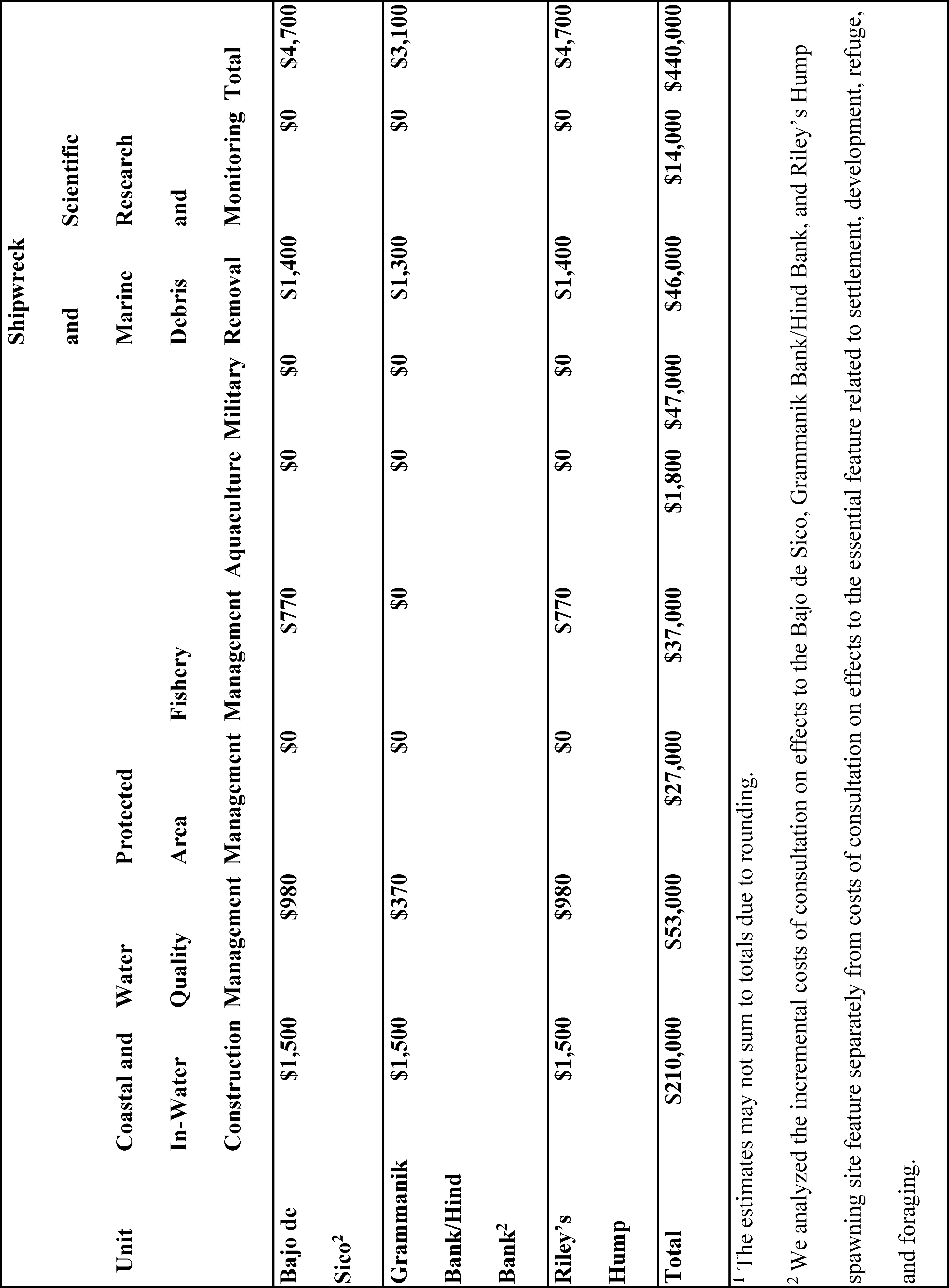
In summary, significant baseline protections exist in the areas proposed for the Nassau grouper critical habitat. The incremental impacts for the Start Printed Page 148 proposed designation are projected to reflect the incremental administrative effort required for section 7 consultations to consider effects to the critical habitat. Taking into consideration several assumptions and uncertainties, total projected incremental costs are approximately $440,000 over the next ten years ($62,000 annualized), applying a discount rate of 7 percent. Notwithstanding the uncertainty underlying the projection of incremental costs, the results provide an indication of the potential activities that may be affected and a reasonable projection of future costs.
National Security Impacts
Impacts to national security could occur if a designation triggers future ESA section 7 consultations because a proposed military activity “may affect” the physical or biological feature(s) essential to the listed species' conservation. Interference with mission-essential training or testing or unit readiness could result if the DoD or USCG were required to modify or delay their actions to prevent adverse modification of critical habitat or implement Reasonable and Prudent Alternatives. Whether national security impacts result from the designation also depends on whether future consultations and associated project modifications and/or implementation of Reasonable and Prudent Measures and Terms and Conditions would otherwise be required due to potential effects to Nassau grouper or other ESA-listed species or designated critical habitat, regardless of the Nassau grouper critical habitat designation.
As described previously, we identified DoD military operations as a category of activity that has the potential to affect the essential features of the designated critical habitat. However, for the actions that may affect Nassau grouper critical habitat, designating critical habitat for Nassau grouper would not result in incremental impacts beyond administrative costs because the consultations would otherwise be required to address effects to either the Nassau grouper or other listed species or the substrate feature of designated critical habitat for corals. In 2022, we requested descriptions and locations of any geographical areas owned or controlled by the DoD or the USCG that may overlap with the areas under consideration for critical habitat that they would like considered for exclusion due to impacts to national security. The USCG responded that maintenance and replacement of fixed Aids to Navigation (AToNs) may affect the proposed habitat by generating sedimentation of the seafloor surrounding piling or other foundations. USCG further indicated that use of floating AToNs may result in removal of the essential feature related to development, refuge, and foraging through chain scouring and placement of the sinker. However, USCG already implements measures to mitigate the impacts of AToN operations to corals, hardbottom, and seagrass, per the programmatic biological opinion on USCG's AToN program (NMFS, 2023). NMFS developed a conference opinion for USCG's ATON program (NMFS, 2023) that considered proposed Nassau grouper critical habitat. NMFS anticipates adopting that conference opinion as the biological opinion once this rule is finalized. As part of that process, NMFS will consider whether and how changes in the final rule affect the determination in the conference opinion; however, NMFS does not anticipate USCG ATON actions in the additional areas designated in this final rule will result in destruction or adverse modification of Nassau grouper critical habitat in the action areas.
The Navy requested that NMFS exclude areas around Naval Air Station Key West from the critical habitat designation under ESA section 4(b)(2). However, the Navy's concerns have been addressed through the previously described INRMP exclusion. No areas managed by other DoD branches were identified as potentially of concern.
Other Relevant Impacts
We identified three broad categories of other relevant impacts of this critical habitat designation: Conservation benefits, both to the species and to the ecosystem; impacts on governmental or private entities that are implementing existing management plans that provide benefits to the listed species; and educational and awareness benefits. Our Impacts Analysis discusses conservation benefits of designating the areas, and the benefits of conserving the species to society.
Conservation Benefits
The primary benefit of critical habitat designation is the contribution to conservation and recovery. That is, in protecting the features essential to the conservation of the species, critical habitat directly contributes to the conservation and recovery of the species. This analysis contemplates two broad categories of conservation benefits of critical habitat designation:
(1) Increased probability of conservation and recovery of the species, and
(2) Ecosystem service benefits.
The most direct benefits of the critical habitat designations stem from the enhanced probability of conservation and recovery of the species. From an economic perspective, the appropriate measure of the value of this benefit is people's “willingness-to-pay” for the incremental change. While the existing economics literature is insufficient to provide a quantitative estimate of the extent to which people value incremental changes in recovery potential, the literature does provide evidence that people have a positive preference for listed species conservation, even beyond any direct ( e.g., recreation, such as viewing the species while snorkeling or diving) or indirect ( e.g., fishing that is supported by the presence of healthy ecosystems) use for the species.
In addition, designating critical habitat can benefit the ecosystem. Overall, coral reef and benthic ecosystems, including those comprising Nassau grouper critical habitat, provide important ecosystem services of value to individuals, communities, and economies. These include recreational opportunities (and associated tourism spending in the regional economy), habitat and nursery functions for recreationally and commercially valuable fish species, shoreline protection in the form of wave attenuation and reduced beach erosion, and climate stabilization via carbon sequestration. Critical habitat most directly influences the recovery potential of the species and protects ecosystem services through its implementation under section 7 of the ESA. Our analysis finds that the final rule is not anticipated to result in incremental project modifications. However, the inclusion of reefs and seagrasses as subcomponents of an essential feature of Nassau grouper critical habitat could increase awareness of the importance of these habitat features, which in turn could lead to additional conservation efforts.
In addition, critical habitat designation may generate ancillary environmental improvements and associated ecosystem service benefits ( i.e., to commercial fishing and recreational activities). While neither benefit can be directly monetized, existing information on the value of coral reefs provides an indication of the value placed on those ecosystems. For example, it is estimated that the top 1 meter of U.S. coral reefs prevents $2.6 billion in indirect economic effects (Reguero et al., 2021) per year, while the total value of direct economic effects has been estimated at roughly $1.7 Start Printed Page 149 billion per year for reefs across Florida, Puerto Rico, and the U.S. Virgin Islands (Brander and Van Beukering, 2013).
Impacts to Governmental and Private Entities With Existing Management Plans Benefitting the Listed Species
Among other relevant impacts of the critical habitat designations that we considered under section 4(b)(2) of the ESA are impacts on the efforts of private and public entities involved in management or conservation efforts benefiting listed species. In cases where there is a federal nexus ( e.g., a federal grant or permit), critical habitat designation could necessitate consultation with NMFS to incrementally address the effects of the management or conservation activities on critical habitat. In such cases, these entities may have to allocate resources to fulfill their section 7 consultation obligations as third parties to the consultation—including the administrative effort of consultation and, potentially, modification of projects or conservation measures to avoid adverse modification to the critical habitat—that, absent critical habitat designation, would be applied to management or conservation efforts benefiting listed species. Thus, the potential for reallocation of these private and public entities' resources would be limited to the incremental administrative costs of section 7 consultations that would occur absent Nassau grouper critical habitat. Therefore, we do not expect that designating critical habitat for the Nassau grouper would diminish private and public entities' ability to provide for the conservation of the Nassau grouper.
Education and Awareness Benefits
The critical habitat designation could potentially have benefits associated with education and awareness. The potential for such benefits stems from three sources: (1) entities that engage in section 7 consultation, including Federal action agencies and, in some cases, third party applicants; (2) members of the general public interested in conservation; and (3) state and local governments that take action to complement the critical habitat designation. Certain entities, such as applicants for particular permits, may alter their activities to benefit the essential features of the critical habitat because they were made aware of the critical habitat designation through the section 7 consultation process. Similarly, Federal action agencies that undertake activities that affect the critical habitat may alter their activities to benefit the critical habitat. Members of the public interested in conservation also may adjust their behavior to benefit critical habitat because they learned of the critical habitat designation through outreach materials or the regulatory process. In our experience, designation raises the public's awareness that there are special considerations to be taken within the area identified as critical habitat. Similarly, state and local governments may be prompted to enact laws or rules to complement the critical habitat designations and benefit the listed species. Those laws would likely result in additional impacts of the designations. However, it is not possible to quantify the beneficial effects of the awareness gained through, or the impacts from state and local regulations resulting from, the critical habitat designation.
Exclusions Under Section 4(b)(2)
We are not exercising our discretion to exclude any particular areas from designation based on economic, national security, and other relevant impacts. There are significant baseline protections that exist in the areas we are designating as the Nassau grouper critical habitat, and as a result, the incremental impacts of the designation are low and reflect the incremental administrative effort required for section 7 consultations to consider the critical habitat. Taking into consideration several assumptions and uncertainties, the total projected incremental costs are approximately $440,000 over the next 10 years ($62,000 annualized), applying a discount rate of 7 percent. Further, the analysis indicates that there is no particular area within the designated critical habitat units where these costs would be highly concentrated. Moreover, we anticipate that no particular industry would be disproportionately impacted. We are not excluding any areas on the basis of national security impacts as no national security concerns exist related to the critical habitat designation. We are not excluding any particular area based on other relevant impacts. Other relevant impacts include conservation benefits of the designation, both to the species and to the ecosystem. We expect that designation of critical habitat will support conservation and recovery of the species. Future section 7 consultations on some of the activities that may affect Nassau grouper will also consider effects to the critical habitat. While we do not expect these consultations to result in additional conservation measures, the additional consideration of effects to the critical habitat will increase overall awareness of the importance of Nassau grouper and its habitat. For these reasons, we are not excluding any areas as a result of these other relevant impacts.
Critical Habitat Designation
Our critical habitat regulations state that we will show critical habitat on a map with more detailed information discussed in the preamble of the critical habitat rulemaking and made available from NMFS (50 CFR 424.12(c)). When several habitats, each satisfying the requirements for designation as critical habitat, are located in proximity to one another, an inclusive area may be designated as critical habitat (50 CFR 424.12(d)). The habitat containing the essential features and that may require special management considerations or protection is marine habitat of particular benthic composition and structure in the Atlantic Ocean and Caribbean Sea. The boundaries of each specific area were determined by the presence of the essential features and Nassau grouper, as described earlier within this document. Because the quality of the available GIS data varies based on collection method, resolution, and processing, the critical habitat boundaries are defined by the maps in combination with the textual information included in the regulation. This textual information clarifies and refines the location and boundaries of each specific area.
Occupied Critical Habitat Unit Descriptions
Based on the available data, we identified specific areas that contain the essential features. The specific areas or “units” can generally be grouped as the: Navassa Island unit, Puerto Rico units, USVI units, Florida units, and spawning units. The units and their general location are listed here (refer to the maps and regulation text for more details).
Navassa Island Unit. Waters surrounding Navassa Island. Area = 2.468 sq. km.
Puerto Rico Unit 1—Mona Island and Monito. Waters between the shoreline out to the 50 m isobaths around Mona and Monito Islands. Area = 30.65 sq. km.
Puerto Rico Unit 2—Desecheo Island. All waters between the shoreline out to the 50 m isobaths around Desecheo Island. Area = 4.28 sq. km.
Puerto Rico Unit 3—Southwest. Waters off the southwest coast of the Puerto Rico main island. Area = 112.39 sq. km.
Puerto Rico Unit 4—Northeast. Waters off the northeast coast of the Puerto Rico main island. Area = 48.75 sq. km. Start Printed Page 150
Puerto Rico Unit 5—Vieques Island. Waters off the west and northeast, east, and southeast coasts of the island. Area = 9.49 sq. km.
Puerto Rico Unit 6—Culebra/Culebrita Islands. The Culebra area consists of waters off the southeastern Culebra coastline. The Culebrita area consists of waters off the western and southern coasts of Culebrita Island. Area = 4.15 sq. km.
United States Virgin Island Unit 1—St Thomas. Waters off the east coast of St. Thomas Island and waters off the southwest, south, and southeast coasts of Water Island. Area = 9.18 sq. km.
United States Virgin Island Unit 2—St. John. Waters off the east coast of St. John Island. Area = 6.55 sq. km.
United States Virgin Island Unit 3—St. Croix. Waters off the east end of St. Croix Island and waters off the north coast of Buck Island. Area = 50.35 sq. km.
Florida Unit 1—Biscayne Bay/Key Largo. Waters south of Rickenbacker Causeway, including portions of waters from the coastline into Biscayne Bay, and waters off the eastern coastline to 80°29′21″ W, 25°01′59″ N. Area = 1279.7 sq. km.
Florida Unit 2—Marathon. Waters off the southern shoreline approximately between Knights Key to 80°55′51″W, 24°46′26″ N. Area = 172.38 sq. km.
Florida Unit 3—Big Pine Key to Geiger Key. Waters off the south side of coastline and US 1 from approximately Geiger Key to Big Pine Key. Area = 372.37 sq. km.
Florida Unit 4—Key West. Shoal waters south of Woman Key. Area = 127.09 sq. km.
Florida Unit 5—New Ground Shoal. New Ground Shoal waters. Area = 31.04 sq. km.
Florida Unit 6—Halfmoon Shoal. Halfmoon Shoal waters. Area = 33.62 sq. km.
Florida Unit 7—Dry Tortugas. Waters encompassing Loggerhead Key and waters surrounding Garden Key and Bush Key. Area = 4.43 sq. km.
Spawning Site Unit 1—Bajo de Sico (Puerto Rico). All waters encompassed by the 100 m isobath within the Bajo de Sico spawning area, which we define here as being bounded by the following coordinates: A) 67°26′13″ W, 18°15′26″ N, B) 67°23′08″ W, 18°15′26″ N, C) 67°23′08″ W, 18°12′56″ N, and D) 67°26′13″ W, 18°12′56″ N. Area = 10.74 sq. km.
Spawning Site Unit 2—Grammanik Bank and Hind Bank (St. Thomas, USVI). All waters which make up the Hind Bank and the Grammanik Bank, interconnecting waters between these banks, and waters extending out to the 200 fathom line directly south from Grammanik Bank. Area = 59.69 sq. km.
Spawning Site Unit 3—Riley's Hump (Dry Tortugas, Florida). All waters encompassing Riley's Hump at 83°6′31″ W, 24°29′42″ N out to the 35 m isobath on the north, west, and east side of the hump, extending out to the 50 m isobath on the south side of the hump to include the escarpment on the southern face of the bank. Area = 15.35 sq. km.
Effects of Critical Habitat Designations
Section 7(a)(2) of the ESA requires Federal agencies, including NMFS, to ensure that any action authorized, funded, or carried out by the agency is not likely to jeopardize the continued existence of any threatened or endangered species or destroy or adversely modify designated critical habitat. Federal agencies are also required to confer with NMFS regarding any actions likely to jeopardize the continued existence of any species for listing under the ESA, or likely to destroy or adversely modify critical habitat, pursuant to section 7(a)(4).
A conference involves informal discussions in which NMFS may recommend conservation measures to minimize or avoid adverse effects (50 CFR 402.02). The discussions and conservation recommendations are documented in a conference report provided to the Federal agency (50 CFR 402.10(e)). If requested by the Federal agency and deemed appropriate by NMFS, the conference may be conducted following the procedures for formal consultation in 50 CFR 402.14, and NMFS may issue an opinion at the conclusion of the conference. This opinion may be adopted as the biological opinion when the species is listed or critical habitat designated if no significant new information or changes to the action alter the content of the opinion (50 CFR 402.10(d)).
When a species is listed or critical habitat is designated, Federal agencies must consult with NMFS on any agency actions that may affect a listed species or its critical habitat. During the consultation, we evaluate the agency action to determine whether the action may adversely affect listed species or critical habitat and issue our findings in a letter of concurrence or in a biological opinion. If we conclude in the biological opinion that the action would likely result in the destruction or adverse modification of critical habitat, we would also identify any reasonable and prudent alternatives to the action. Reasonable and prudent alternatives are defined in 50 CFR 402.02 as alternative actions identified during formal consultation that can be implemented in a manner consistent with the intended purpose of the action, that can be implemented consistent with the scope of the Federal agency's legal authority and jurisdiction, that are economically and technologically feasible, and that we believe would avoid the likelihood of destruction or adverse modification of critical habitat.
Regulations at 50 CFR 402.16 require Federal agencies that have retained discretionary involvement or control over an action, or where such discretionary involvement or control is authorized by law, to reinitiate consultation on previously reviewed actions in instances where:
(1) Critical habitat is subsequently designated that may be affected by the identified action; or
(2) New information or changes to the action may result in effects to critical habitat in a manner or to an extent not previously considered.
Consequently, some Federal agencies may request re-initiation of consultation or conference with NMFS on actions for which formal consultation has been completed, if those actions may affect designated critical habitat or adversely modify or destroy proposed critical habitat.
Activities subject to the ESA section 7 consultation process are those activities authorized, funded, or carried out by Federal action agencies, whether on Federal, state, or private lands or waters. ESA section 7 consultation would not be required for Federal actions that do not affect listed species or critical habitat and for actions that are not federally funded, authorized, or carried out.
Activities That May Be Affected
Section 4(b)(8) of the ESA requires that we describe briefly and evaluate in any proposed or final regulation to designate critical habitat those activities, whether public or private, that may adversely modify such habitat or that may be affected by such designation. As described in our Critical Habitat Report, a wide variety of Federal activities may require ESA section 7 consultation because they may affect the essential features of Nassau grouper critical habitat. Specific future activities will need to be evaluated with respect to their potential to destroy or adversely modify critical habitat, in addition to their potential to affect and jeopardize the continued existence of listed species. For example, activities may adversely modify the substrate portion of the development essential feature by removing or altering the substrate. These activities, whether public or private, would require ESA section 7 Start Printed Page 151 consultation when they are authorized, funded, or carried out by a Federal agency. A private entity may also be affected by these critical habitat designations if it is a proponent of a project that requires a Federal permit or receives Federal funding. Categories of activities that may be affected through section 7 consultation by designating Nassau grouper critical habitat include coastal and in-water construction, protected area management, fishery management, scientific research and monitoring, derelict vessel and marine debris removal, aquaculture, water quality management, and military activities.
Questions regarding whether specific activities may constitute destruction or adverse modification of critical habitat should be directed to us (see ADDRESSES and FOR FURTHER INFORMATION CONTACT ).
Identifying the extent or severity of an impact on the essential features at which the conservation value of habitat for the listed species may be affected is inherently complex. Consequently, the actual responses of the critical habitat to effects to the essential features resulting from future Federal actions will be case and site-specific, and predicting such responses will require case and site-specific data and analyses.
Information Quality Act and Peer Review
The data and analyses supporting this action have undergone a pre-dissemination review and have been determined to be in compliance with applicable information quality guidelines implementing the Information Quality Act (Section 515 of Pub. L. 106–554). On December 16, 2004, OMB issued its Final Information Quality Bulletin for Peer Review (Bulletin). The Bulletin was published in the Federal Register on January 14, 2005 (70 FR 2664), and all of the requirements were effective by June 16, 2005. The primary purpose of the Bulletin is to improve the quality and credibility of scientific information disseminated by the Federal government by requiring peer review of “influential scientific information” and “highly influential scientific assessments” prior to public dissemination. “Influential scientific information” is defined as information that the agency reasonably can determine will have or does have a clear and substantial impact on important public policies or private sector decisions. The Bulletin provides agencies broad discretion in determining the appropriate process and level of peer review of influential scientific information. Stricter standards were established for the peer review of highly influential scientific assessments, defined as information whose dissemination could have a potential impact of more than $500 million in any one year on either the public or private sector or for which the dissemination is novel, controversial, or precedent-setting, or has significant interagency interest.
The information in the Critical Habitat Report supporting this final critical habitat rule is considered influential scientific information and subject to peer review. To satisfy our requirements under the OMB Bulletin, we obtained independent peer review of the information used to draft this report and incorporated the peer review comments into the draft Critical Habitat Report prior to dissemination of the Final Critical Habitat Report and completion of this rule. Comments received from peer reviewers are available on our website at http://www.cio.noaa.gov/services_programs/prplans/ID346.html.
Classification
Takings (Executive Order 12630)
Under E.O. 12630, Federal agencies must consider the effects of their actions on constitutionally protected private property rights and avoid unnecessary takings of private property. A taking of property includes actions that result in physical invasion or occupancy of private property and regulations imposed on private property that substantially affect its value or use. In accordance with E.O. 12630, this final rule would not have significant takings implications. A takings implication assessment is not required. These designations would affect only Federal agency actions ( i.e., those actions authorized, funded, or carried out by Federal agencies). Therefore, the critical habitat designations do not affect landowner actions that do not require Federal funding or permits. We anticipate that the designation of critical habitat for the Nassau grouper will result in no section 7 consultations and no restrictions on federally permitted landowner actions beyond those that would already be required due to pre-existing protections to ESA-listed species and designated critical habitat. The only incremental costs incurred by landowners would be minor administrative costs associated with considering effects of the action on Nassau grouper critical habitat in section 7 consultations that would be required absent the designation. Thus, Nassau grouper critical habitat is not expected to affect land values or use.
Regulatory Planning and Review (Executive Order 12866)
This rule has been determined to be significant for purposes of E.O. 12866, as amended by Executive Order 14094. Executive Order 14094, which amends E.O. 12866 and reaffirms the principles of E.O. 12866 and E.O 13563, states that regulatory analysis should facilitate agency efforts to develop regulations that serve the public interest, advance statutory objectives, and be consistent with E.O. 12866, E.O. 13563, and the Presidential Memorandum of January 20, 2021 (Modernizing Regulatory Review). Regulatory analysis, as practicable and appropriate, shall recognize distributive impacts and equity, to the extent permitted by law. E.O. 13563 emphasizes further that regulations must be based on the best available science and that the rulemaking process must allow for public participation and an open exchange of ideas. We have developed this rule in a manner consistent with these requirements.
Based on the economic impacts evaluation in the Critical Habitat Report, total incremental costs resulting from the critical habitat are approximately $440,000 over the next 10 years ($62,000 annualized), applying a discount rate of 7 percent. These total impacts include the additional administrative efforts necessary to consider critical habitat in section 7 consultations. Overall, economic impacts are expected to be small and to be largely associated with the administrative costs borne by Federal agencies.
Federalism (Executive Order 13132)
Pursuant to the Executive Order on Federalism, E.O. 13132, we determined that this final rule does not have significant federalism effects and that a federalism assessment is not required. The designation of critical habitat directly affects only the responsibilities of Federal agencies. As a result, this rule does not have substantial direct effects on the States or territories, on the relationship between the national government and the States, or on the distribution of power and responsibilities among the various levels of government, as specified in E.O. 13132. State or local governments may be indirectly affected by this critical habitat designation if they require Federal funds or formal approval or authorization from a Federal agency as a prerequisite to conducting an action. In these cases, the State or local government agency may participate in the ESA section 7 Start Printed Page 152 consultation as a third party. One of the key conclusions of the economic impact analysis is that the incremental impacts of the critical habitat designation will likely be limited to additional administrative costs to NMFS and Federal agencies stemming from the need to consider impacts to critical habitat as part of the forecasted section 7 consultations. The designation of critical habitat is not expected to have substantial indirect impacts on State or local governments.
Energy Supply, Distribution, and Use (Executive Order 13211)
Executive Order 13211 requires agencies to prepare Statements of Energy Effects when undertaking an action expected to lead to the promulgation of a final rule or regulation that is a significant regulatory action under E.O. 12866 and is likely to have a significant adverse effect on the supply, distribution, or use of energy. OMB Guidance on Implementing E.O. 13211 (July 13, 2001) states that significant adverse effects could include any of the following outcomes compared to a world without the regulatory action under consideration: (1) reductions in crude oil supply in excess of 10,000 barrels per day; (2) reductions in fuel production in excess of 4,000 barrels per day; (3) reductions in coal production in excess of 5 million tons per year; (4) reductions in natural gas production in excess of 25 million cubic feet per year; (5) reductions in electricity production in excess of 1 billion kilowatt-hours per year or in excess of 500 megawatts of installed capacity; (6) increases in energy use required by the regulatory action that exceed any of the thresholds above; (7) increases in the cost of energy production in excess of 1 percent; (8) increases in the cost of energy distribution in excess of 1 percent; or (9) other similarly adverse outcomes. A regulatory action could also have significant adverse effects if it: (1) adversely affects in a material way the productivity, competition, or prices in the energy sector; (2) adversely affects in a material way productivity, competition or prices within a region; (3) creates a serious inconsistency or otherwise interferes with an action taken or planned by another agency regarding energy; or (4) raises novel legal or policy issues adversely affecting the supply, distribution or use of energy arising out of legal mandates, the President's priorities, or the principles set forth in E.O. 12866 and 13211.
As discussed above and in the Critical Habitat Report, the critical habitat designations are not expected to affect oil and gas or renewable energy production. Therefore, this rule will not have a significant adverse effect on the supply, distribution, or use of energy. Therefore, we have not prepared a Statement of Energy Effects.
Regulatory Flexibility Act (5 U.S.C. 601 et seq.)
We prepared a final regulatory flexibility analysis (FRFA) pursuant to section 603 of the Regulatory Flexibility Act (RFA) (5 U.S.C. 601 et seq.), as amended by the Small Business Regulatory Enforcement Fairness Act (SBREFA) of 1996. The FRFA analyzes the impacts to small entities that may be affected by the critical habitat designations, and is included as Appendix B of the Critical Habitat Report ( https://www.fisheries.noaa.gov/s3/2023-12/Nassau-grouper-critical-habitat-final-report.pdf). We received no comments on our initial regulatory flexibility analysis (IRFA). Results of the FRFA are summarized below.
Our FRFA uses the best available information to identify the potential impacts of designating critical habitat on small entities. However, a number of uncertainties complicate quantification of these impacts. These include (1) the fact that the manner in which these potential impacts will be allocated between large and small entities is unknown; and (2) uncertainty regarding the potential effects of critical habitat designation, which requires some categories of potential impacts be described qualitatively. Absent specific knowledge regarding which small entities may be involved in consultations with NMFS over the next 10 years, this analysis relies on industry- and location-specific information on small businesses with North American Industry Classification System codes that were identified as relevant to the major activity categories considered in the economic analysis and which operate within counties or territories that share a coastline with the critical habitat. Activities considered in the economic analysis and the FRFA include in-water and coastal construction, water quality management, protected area management, fishery management, aquaculture, military, scientific research and monitoring, and derelict vessel and marine debris removal. Based on the relevant consultation history and forecast of future activities that may affect the determined critical habitat, only in-water and coastal construction activities are anticipated to involve third parties that qualify as small entities. Given the uncertainty regarding the proportion of consultations on construction activities that will involve third parties, the analysis conservatively assumes that all future consultations on these activities will involve third parties and that all of these third parties will be small entities. All of the counties and territories that share a coastline with the designated critical habitat have populations of more than 50,000, so no impacts to small governmental jurisdictions are expected as a result of the critical habitat designation.
The maximum total annualized impacts to small entities are estimated to be $4,221, which represents approximately 7 percent of the total quantified incremental impacts forecasted to result from the final rule. This estimate reflects incremental administrative costs, such as written and verbal communication with NMFS and other Federal action agencies, at a rate of $100/hour and ranging from approximately 1.5 hours providing technical assistance to approximately 10.25 hours engaging in formal consultation (see Exhibit C.1 and accompanying text, Summary of Estimated Impacts to Small Entities by Activity Type, in Appendix C of the Critical Habitat Report, https://www.fisheries.noaa.gov/s3/2023-12/Nassau-grouper-critical-habitat-final-report.pdf). These impacts are anticipated to be borne by the small entities in the construction industry that obtain funds or permits from Federal agencies that will consult with NMFS regarding Nassau grouper critical habitat in the next 10 years.
Given the uncertainty regarding which small entities in a given industry will need to consult with NMFS, the analysis estimates impacts to small entities under two different scenarios. These scenarios are intended to reflect the range of uncertainty regarding the number of small entities that may be affected by the designation and the potential impacts of critical habitat designation on their annual revenues. Under both scenarios, the FRFA assumes that entities conducting in-water and coastal construction activities in the Florida units are limited to those entities located in Miami-Dade and Monroe Counties, entities conducting in-water and coastal construction activities in the Puerto Rico units are limited to those entities located in Puerto Rico, and entities conducting in-water and coastal construction activities in the USVI units are limited to those entities located in the USVI. Estimated annualized impacts for both scenarios are calculated by multiplying the forecasted number of annual consultations involving third parties by the administrative costs per Start Printed Page 153 consultation estimated to be borne by small entities. Absent specific knowledge regarding the timing of future consultations involving third parties, the FRFA further assumes under both scenarios that an equal number of such consultations will occur each year over the next ten years.
Under Scenario 1, the analysis assumes that all third parties involved in future consultations are small and that incremental impacts are distributed evenly across all of these entities. For the Florida units, where we estimate approximately 400 small entities participate in the in-water and coastal construction industry (see Exhibit B–1 in Appendix B of the Critical Habitat Report, https://www.fisheries.noaa.gov/s3/2023-12/Nassau-grouper-critical-habitat-final-report.pdf), Scenario 1 accordingly reflects a high estimate of the number of potentially affected small entities (6.4) and a low estimate of the potential effect in terms of percent of revenue. The assumption under Scenario 1 that 6.4 small entities will be subject to consultation annually reflects the forecast that 6.4 consultations will occur annually on in-water and coastal construction activities involving third parties. This assumes that each consultation within the in-water and coastal construction industry involves a unique small entity. This scenario, therefore, may overstate the number of small entities based in Miami-Dade and Monroe counties that are likely to be affected by the rule and understate the revenue effect. Scenario 1 also assumes that each consultation within the in-water and coastal construction industry in the Puerto Rico and USVI units involves a unique small entity. For the Puerto Rico units, because section 7 consultation on construction activities is anticipated to occur at a rate of 0.8 per year, or eight consultations over 10 years, we assume that 0.8 small entities will be impacted per year. Similarly, because section 7 consultation on construction activities affecting the USVI units is anticipated to occur at a rate of 0.8 per year, or eight consultations over 10 years, we assume that 0.8 USVI-based small entities will be impacted per year. Therefore, Scenario 1 does not yield the same overstatement of the number of small entities likely to be affected (unless the third party entities involved in the consultations on the construction activities in Puerto Rico and USVI are not small entities) or the same understatement of the revenue effect for these jurisdictions. The analysis anticipates that, across the three jurisdictions where there are small entities that are assumed to conduct in-water and coastal construction, approximately eight small entities will incur $4,221 in annualized costs under Scenario 1, including $527 in costs to Florida-based small entities, $513 in costs to Puerto Rico-based small entities, and $549 in costs to USVI-based small entities. Annualized impacts of the rule are estimated to make up less than 1 percent of average annual revenues of approximately $1.31 million for each affected small entity (see Exhibit B–1 in Appendix B of the Critical Habitat Report, https://www.fisheries.noaa.gov/s3/2023-12/Nassau-grouper-critical-habitat-final-report.pdf). This percentage would be higher for a small entity with annual revenues lower than the average of annual revenues of all potentially impacted small entities, and lower for a small entity with annual revenues higher than the average of annual revenues of all potentially impacted small entities.
Under Scenario 2, the analysis assumes that all third parties participating in future consultations are small and that costs associated with each consultation action are borne each year by a single small entity within an industry. This method likely understates the number of small entities affected and overstates the likely impacts on an entity for the Florida units. As such, this method arrives at a low estimate of potentially affected entities in Florida units and a high estimate of potential effects on revenue, assuming that quantified costs represent a complete accounting of the costs likely to be borne by private entities. Under Scenario 2, $3,379 in annualized impacts would be borne by a single small entity in Florida. We maintain the assumption in Scenario 1 that 0.8 small entities per year bear the third party costs of consultation in Puerto Rico and 0.8 small entities per year bear the third party costs of consultation in USVI. This assumption reflects our forecast of eight consultations on construction projects over 10 years in both Puerto Rico and USVI. This scenario forecasts that annualized impacts to single entities in both Puerto Rico and USVI would be $513 and $549, respectively. Though this scenario almost certainly overstates the costs borne by a single small entity in Florida, the impact is nonetheless expected to represent less than 1 percent of the average annual revenues for the single entity. Impacts to single small entities in Puerto Rico and USVI are also anticipated to be less than 1 percent of average annual revenues. As with Scenario 1, this percentage would be higher for a small entity with annual revenues lower than the average of annual revenues of all potentially impacted small entities, and lower for a small entity with annual revenues higher than the average of annual revenues of all potentially impacted small entities.
While these scenarios present a range of potentially affected entities and the associated revenue effects in Florida, our analysis demonstrates that the greatest potential revenue effect is less than 1 percent across scenarios and jurisdictions. Moreover, although we cannot definitively determine the numbers of small and large entities that may be affected by this final rule, there is no indication that affected project applicants would be only small entities or mostly small entities. It is unclear whether small entities would be placed at a competitive disadvantage compared to large entities.
No Federal laws or regulations duplicate or conflict with this final rule. However, other aspects of the ESA may overlap with the critical habitat designations. For instance, listing of the Nassau grouper under the ESA requires Federal agencies to consult with NMFS to ensure against jeopardy to the species. Overlap of the presence of other ESA-listed species, including listed corals, and coral critical habitat with the areas designated as critical habitat protects the essential features of the critical habitat to the extent that projects or activities that may adversely affect the critical habitat also pose a threat to the listed species or to coral critical habitat. Several fishery management plans, developed under the authority of the Magnuson-Stevens Fishery Conservation and Management Act, serve to prevent overfishing of Nassau grouper prey and promote the spawning, breeding, feeding, and growth to maturity of reef fish such as the Nassau grouper. Overlap of the final Nassau grouper critical habitat with several Federal protected areas affords the critical habitat extensive protections against potentially damaging activities. Some of these consultations on activities associated with these protections will need to be reviewed to consider potential effects to Nassau grouper critical habitat.
The RFA requires consideration of alternatives to the final rule that would minimize significant economic impacts to small entities. We considered the following alternatives when developing the final critical habitat rule.
Alternative 1: No Action Alternative
Under this status quo alternative, we would not designate critical habitat for Start Printed Page 154 the Nassau grouper. Conservation and recovery of the listed species would depend exclusively upon the protection provided under the “jeopardy” provisions of section 7 of the ESA. Under the status quo, there would be no increase in the number of ESA consultations in the future that would not otherwise be required due to the listing of the Nassau grouper. However, we have determined that the physical and biological features forming the basis for our critical habitat designation are essential to the Nassau grouper's conservation, and conservation of the species will not succeed without these features being available. Thus, the lack of protection of the critical habitat features from adverse modification could result in continued declines in abundance of Nassau grouper, and loss of associated economic and other values the species provides to society, such as commercial diving services. Small entities engaged in industries that depend on the presence of Nassau grouper or elements of the species' critical habitat, particularly coral reefs, would be adversely affected by continued declines in the Nassau grouper. Thus, the no action alternative is not necessarily a “no cost” alternative for small entities. Moreover, because the ESA requires designation of critical habitat to the maximum extent prudent and determinable, and in this case critical habitat is both prudent and determinable, this option would not be legally viable under the ESA.
Alternative 2: Preferred Alternative
Under this alternative, the areas designated are waters from the shoreline to depths ranging from 2 m to 30 m in seven units in Florida, six units in Puerto Rico, three units in USVI, and one unit at Navassa Island; and in deeper, offshore waters up to 200 fathoms (366 m) deep off the Riley's Hump, Bajo de Sico, Grammanik, and Hind Banks spawning sites. An analysis of the costs and benefits of the preferred alternative designation is presented in Section 10.1 of the Critical Habitat Report. Relative to the no action alternative, this alternative will likely result in an increase in administrative costs of section 7 consultations that would already occur absent designation. We have determined that no categories of activities would require consultation, and no project modifications would be required, in the future solely due to this rule and the need to prevent adverse modification of the designated critical habitat. However, due to the protections afforded the essential features of the designated critical habitat under this alternative, it is likely that consultations on future Federal actions within those categories of activities will require additional administrative effort to address specific impacts to Nassau grouper critical habitat. This additional administrative effort would be an incremental impact of this rule. Consultation costs associated with those projects with larger or more diffuse action areas, i.e., projects that may affect a wider range of listed species or critical habitats, would likely be largely coextensive with listings or other regulatory requirements.
The preferred alternative was selected because it best implements the critical habitat provisions of the ESA by including the well-defined environmental features that we can clearly state are essential to the species' conservation, and because this alternative would reduce the economic impacts on entities relative to an alternative that encompasses a larger geographical area (see Alternative 3). Also, as noted above, Alternative 1, would fail to meet statutory requirements for designation of critical habitat; and, as described below, Alternative 3, would not adequately reflect the best available science and our consideration of economic impacts.
Alternative 3: Different Geographic Boundaries
We considered a third alternative that would have delineated the designation for all nearshore units containing the development, refuge, and foraging essential feature based a single depth contour of 30 m. We evaluated this alternative based on our experience with the 2008 Acropora critical habitat designation, which created a single designation for both acroporid corals species from 0 to 30 m depth, generally, and to ensure inclusion across units of areas where the growth and development essential feature is abundant. However, the areas in which the development, refuge, and foraging essential feature is sufficiently abundant and contiguously located to appreciably promote conservation of the species comprise variable depth swaths across units. Under Alternative 3, a larger number of future Federal activities could affect the Nassau grouper critical habitat and trigger the need for ESA section 7 consultation, resulting in higher incremental administrative costs compared to the preferred alternative. Thus, we rejected this alternative because, relative to the preferred alternative, it would likely increase incremental costs of the final rule to small entities without incrementally promoting conservation of the species.
In the final rule, we selected Alternative 2 because it provides for the conservation of the species while reducing the economic, national security, and other relevant impacts on affected entities.
Coastal Zone Management Act
We have determined that this action will have no reasonably foreseeable effects on the enforceable policies of approved coastal zone management plans in Florida, Puerto Rico, and USVI.
Paperwork Reduction Act of 1995 (44 U.S.C. 3501 et seq.)
This rule does not contain any new or revised collection of information requirements. This rule will not impose recordkeeping or reporting requirements on State or local governments, individuals, businesses, or organizations. Therefore, the Paperwork Reduction Act does not apply.
Unfunded Mandates Reform Act (2 U.S.C. 1501 et seq.)
This rule will not produce a Federal mandate. The designation of critical habitat does not impose a legally-binding duty on non-Federal government entities or private parties. The only regulatory effect is that Federal agencies must ensure that their actions are not likely to destroy or adversely modify critical habitat under section 7 of the ESA. Non-Federal entities that receive Federal funding, assistance, permits or otherwise require approval or authorization from a Federal agency for an action may be indirectly impacted by the designation of critical habitat, but the Federal agency has the legally binding duty to avoid destruction or adverse modification of critical habitat. We do not anticipate that this rule will significantly or uniquely affect small governments. Therefore, a Small Government Action Plan is not required.
Consultation and Coordination With Indian Tribal Governments (Executive Order 13175)
The longstanding and distinctive relationship between the Federal and tribal governments is defined by treaties, statutes, executive orders, judicial decisions, and agreements, which differentiate tribal governments from the other entities that deal with, or are affected by, the Federal government.
This relationship has given rise to a special Federal trust responsibility involving the legal responsibilities and obligations of the United States toward Indian Tribes and with respect to Indian lands, tribal trust resources, and the exercise of tribal rights. Pursuant to these authorities, lands have been Start Printed Page 155 retained by Indian Tribes or have been set aside for tribal use. These lands are managed by Indian Tribes in accordance with tribal goals and objectives within the framework of applicable treaties and laws. Executive Order 13175, Consultation and Coordination with Indian Tribal Governments, outlines the responsibilities of the Federal government in matters affecting tribal interests.
In developing this rule, we reviewed maps and did not identify any areas designated as critical habitat that overlap with tribal lands, nor do we anticipate impacts on tribal fisheries as a result of these critical habitat designations. Based on this, we found the critical habitat designations for Nassau grouper do not have tribal implications.
Environmental Justice and Racial Equity (E.O.s 12898, 14096, 14019, 13985)
The designation of critical habitat is not expected to have a disproportionately high effect on minority populations or low-income populations. The purpose of this rule is to protect and conserve ESA-listed species through the designation of critical habitat and is expected to help promote a healthy environment; thus, we do not anticipate minority populations or low-income populations to experience disproportionate and adverse human health or environmental burdens. The designation of critical habitat is not expected to disproportionately affect minority populations, low-income populations, or populations otherwise adversely affected by persistent poverty or inequality. Further, it is not expected to create any barriers to opportunity for underserved communities. The proposed rule was widely distrusted, including to the affected States and territorial governments. We did not receive any public comment suggesting the designation would result in effects these communities.
References Cited
A complete list of all references cited in this rulemaking can be found on our Website at https://www.fisheries.noaa.gov/species/nassau-grouper#conservation-management and is available upon request from NMFS (see ADDRESSES ).
Start List of SubjectsList of Subjects
50 CFR Part 223
- Endangered and threatened species
- Exports
- Imports
- Transportation
50 CFR Part 226
- Endangered and threatened species
End SignatureSamuel D. Rauch, III,
Deputy Assistant Administrator for Regulatory Programs, National Marine Fisheries Service.
For the reasons set out in the preamble, NOAA amends 50 CFR parts 223 and 226 as follows:
Start PartPART 223—THREATENED MARINE AND ANADROMOUS SPECIES
End Part Start Amendment Part1. The authority citation for part 223 continues to read as follows:
End Amendment Part Start Amendment Part2. In § 223.102, amend the table in paragraph (e) by revising the entry under the “Fishes” subheading for “Grouper, Nassau” to read as follows:
End Amendment PartStart PartEnumeration of threatened marine and anadromous species.* * * * *(e) * * *
Species 1 Citation(s) for listing determination(s) Critical habitat ESA rules Common name Scientific name Description of listed entity * * * * * * * Fishes * * * * * * * Grouper, Nassau Epinephelus striatus Entire species 81 FR 42268, June 29, 2016 [ Insert 226.231] NA * * * * * * * 1 Species includes taxonomic species, subspecies, distinct population segments (DPSs) (for a policy statement, see 61 FR 4722, February 7, 1996), and evolutionarily significant units (ESUs) (for a policy statement, see 56 FR 58612, November 20, 1991). * * * * *PART 226—DESIGNATED CRITICAL HABITAT
End Part Start Amendment Part3. The authority citation for part 226 continues to read as follows:
End Amendment Part Start Amendment Part4. Add § 226.231 to read as follows:
End Amendment PartCritical habitat for the Nassau grouper.Critical habitat is designated in the following state and territories as depicted in the maps below and described in paragraphs (a) through (d) of this section. The maps as clarified by the textual descriptions in this section are the definitive sources for determining the critical habitat boundaries.
(a) Critical habitat boundaries. Except as noted in paragraph (c) of this section, critical habitat is defined as:
(1) Navassa Island—All waters surrounding Navassa Island, from the shoreline to the 30 m isobath.
(2) Puerto Rico Unit 1—Isla de Mona and Monito—All waters surrounding the islands of Mona and Monito from the shoreline to the 50 m isobath.
(3) Puerto Rico Unit 2—Desecheo Island—All waters surrounding the island of Desecheo from the shoreline to the 50 m isobath.
(4) Puerto Rico Unit 3—Southwest—All waters from the southwestern shoreline of Puerto Rico, between Playa Tres Tubos just south Mayaguez and Punta Ballena in Guanica, extending offshore to depths of about 10 m and, near La Parguera, to depths of about 15 m.
(5) Puerto Rico Unit 4—Northeast—All waters from the northeastern shoreline of Puerto Rico out to depths Start Printed Page 156 of about 10 m between Cabeza Chiquita and Punta Lima.
(6) Puerto Rico Unit 5—Vieques Island—There are two areas that make up this unit. First, all waters from the southwestern shoreline out to the inner reef in depths of about 2 m between Punta Boca Quebrada and Punta Vaca. Second, all waters from the southeastern and northeastern shorelines out to the inner reef in depths of about 2 m between Punta Mulas and Ensenada Honda near Cayo Jalovita.
(7) Puerto Rico Unit 6—Isla de Culebra—There are two areas that make up this unit. First, all waters from the southeastern shoreline of Isla de Culebra out to the reef ledge in depths of about 15 m between Punta del Soldado and Cabeza de Perro, excluding the bays of Puerto del Manglar and Ensenada Honda. Second, all waters from the southern shoreline of Isla Culebrita out to the nearshore reef in depths of about 5 m between the western point of the island and Punta del Este.
(8) United State Virgin Islands Unit 1—St. Thomas—There are two areas that make up this unit. First, all waters off the southeast end of St. Thomas between Stalley Bay and Cabrita Point out to the reef ledge in depths of about 15 m and surrounding Great St. James, Little St. James, and Dog Islands. Second, all waters on the south side of Water Island from the shoreline out to the coral reef in depths of about 5 m between Druif Point and the south end of Sand Bay.
(9) United States Virgin Islands Unit 2—St. John—All waters on the east end of St. John from the shoreline out to the inner coral reef in depths of about 2 m between White Point on the south coast and Leinster Point on the north coast.
(10) United States Virgin Islands Unit 3—St. Croix—There are two areas that make up this unit. First, all waters on the east end of St. Croix from the shoreline to the outer coral reef edge in depths of about 10 m on the north coast and 15 m on the eastern point and south coast between Batiste Point and Pelican Cove Beach, excluding the Christiansted navigation channel. Second, all waters on the north side of Buck Island between the shoreline and the coral reef in depths of about 5 m.
(11) Florida Unit 1—Biscayne Bay/Key Largo—All waters of Biscayne Bay (bounded on the north by the Rickenbacker Causeway), Card Sound (bounded on the south by Card Sound Road), and the Atlantic Ocean out to the coral reef and hardbottom in depths of about 20 m between Stiltsville, south of Cape Florida, and Harry Harris Beach Park near the south end of Key Largo, excluding the Intracoastal Waterway; unit overlaps areas of Miami-Dade and Monroe County.
(12) Florida Unit 2—Marathon—All waters from the southern shoreline of the City of Marathon in Monroe County out to the 15 m isobath between Knights Key and Grassy Key, excluding the Boot Key navigation channel.
(13) Florida Unit 3—Big Pine Key to Geiger Key—All waters south of U.S. Highway 1 out to the 15 m isobath between the eastern point of Big Pine Key and Geiger Key in Monroe County.
(14) Florida Unit 4—Key West—All shoal waters south of Woman Key between 5 and 30 m depth that contain coral reef and hardbottom and seagrass habitat in Monroe County.
(15) Florida Unit 5—New Ground Shoal—All New Ground Shoal waters shown in the map below for this unit in Monroe County.
(16) Florida Unit 6—Halfmoon Shoal—All Halfmoon Shoal Waters shown in the map below for this unit in Monroe County.
(17) Florida Unit 7—Dry Tortugas—There are three areas which make up this unit located in Monroe County. First, all waters surrounding Loggerhead Key to depths of about 2 m. Second, all waters surrounding Garden Key to depths out to about 3.5 m. Third, all waters surrounding Bush Key to depths out to about 5.5 m.
(18) Spawning Site Unit 1—Bajo de Sico—All waters encompassed by the 100 m isobath in the Bajo de Sico area.
(19) Spawning Site Unit 2—Grammanik Bank/Hind Bank—All waters which make up the Hind Bank and the Grammanik Bank, interconnecting waters between these banks, and waters extending out to the 200 fathom line directly south from Grammanik Bank.
(20) Spawning Site Unit 3—Riley's Hump—All waters encompassing Riley's Hump located southwest of the Dry Tortugas out to the 35 m isobath on the north, west, and east side of the hump and out to the 50 m isobath on the south side of the hump.
(b) Essential features. The features essential to the conservation of Nassau grouper are:
(1) Recruitment and developmental habitat. Areas from nearshore to offshore necessary for recruitment, development, and growth of Nassau grouper containing a variety of benthic types that provide cover from predators and habitat for prey, consisting of the following:
(i) Nearshore shallow subtidal marine nursery areas with substrate that consists of unconsolidated calcareous medium to very coarse sediments (not fine sand) and shell and coral fragments and may also include cobble, boulders, whole corals and shells, or rubble mounds, to support larval settlement and provide shelter from predators during growth and habitat for prey.
(ii) Intermediate hardbottom and seagrass areas in close proximity to the nearshore shallow subtidal marine nursery areas that protect growing fish from predation as they move from nearshore nursery areas into deeper waters and provide habitat for prey. The areas include seagrass interspersed with areas of rubble, boulders, shell fragments, or other forms of cover; inshore patch and fore reefs that provide crevices and holes; or substrates interspersed with scattered sponges, octocorals, rock and macroalgal patches, or stony corals.
(iii) Offshore linear and patch reefs in close proximity to intermediate hardbottom and seagrass areas that contain multiple benthic types, for example, coral reef, colonized hardbottom, sponge habitat, coral rubble, rocky outcrops, or ledges, to provide shelter from predation during maturation and habitat for prey.
(iv) Structures between the subtidal nearshore area and the intermediate hardbottom and seagrass area and the offshore reef area including overhangs, crevices, depressions, blowout ledges, holes, and other types of formations of varying sizes and complexity to support juveniles and adults as movement corridors that include temporary refuge that reduce predation risk as Nassau grouper move from nearshore to offshore habitats.
(2) Spawning habitat. Marine sites used for spawning and adjacent waters that support movement and staging associated with spawning.
(c) Areas not included in critical habitat. Critical habitat does not include:
(1) Managed areas where the substrate is continually disturbed by planned management activities authorized by local, state, or Federal governmental entities at the time of critical habitat designation, and that will continue to be disturbed by such management. Examples include, but are not necessarily limited to, dredged navigation channels, shipping basins, vessel berths, and active anchorages.
(2) Pursuant to ESA section 4(a)(3)(B), all area subject to the Naval Air Station Key West Integrated Natural Resources Management Plan.
(d) Maps of Nassau grouper critical habitat. (1) Spatial data for these critical habitats and mapping tools are maintained on our website and are available for public use ( www.fisheries.noaa.gov/national/ Start Printed Page 157 endangered-species-conservation/critical-habitat ).
(2) Overview maps of each final critical habitat unit follow.
Start Printed Page 158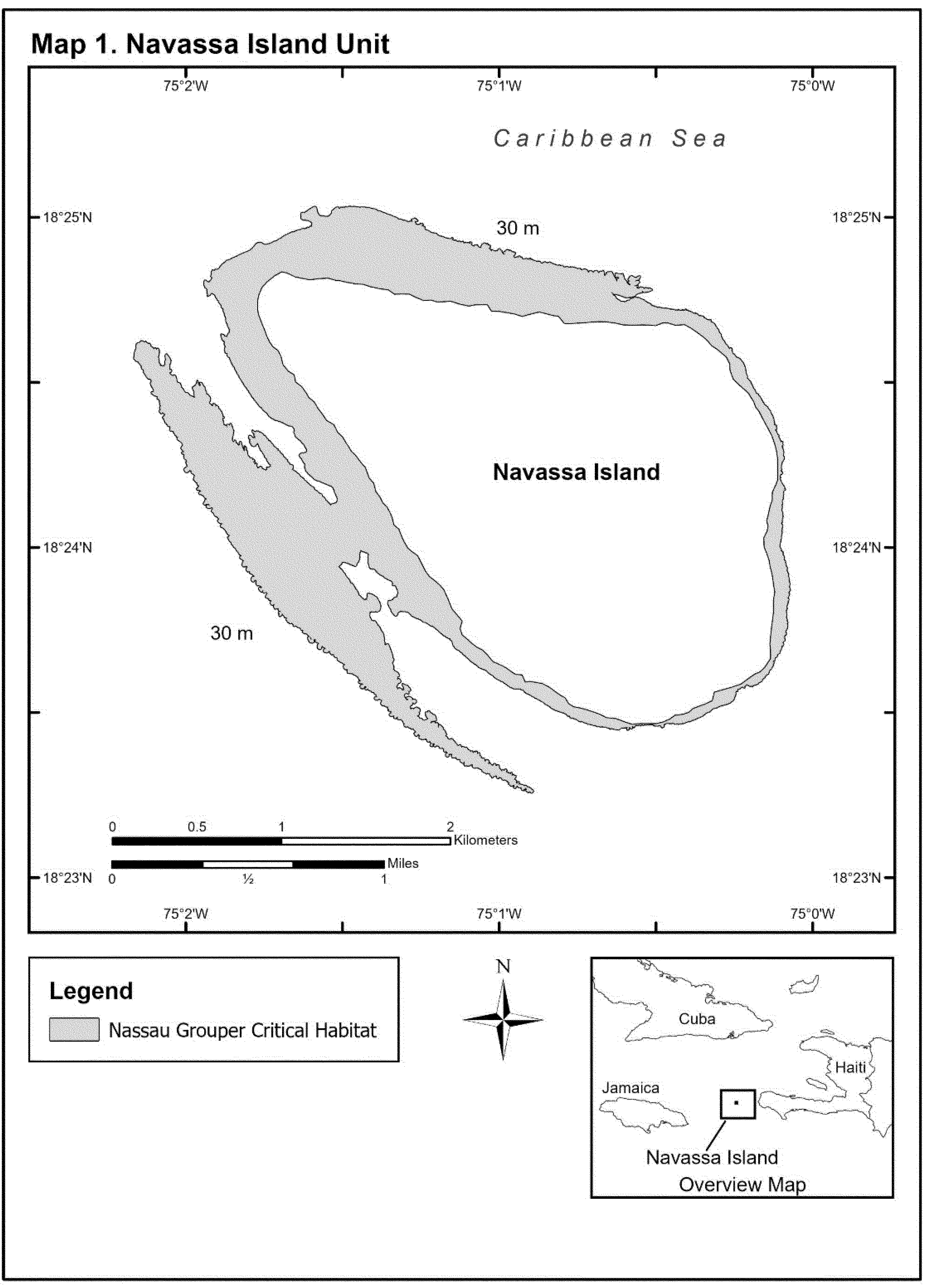
Start Printed Page 159
Start Printed Page 160
Start Printed Page 161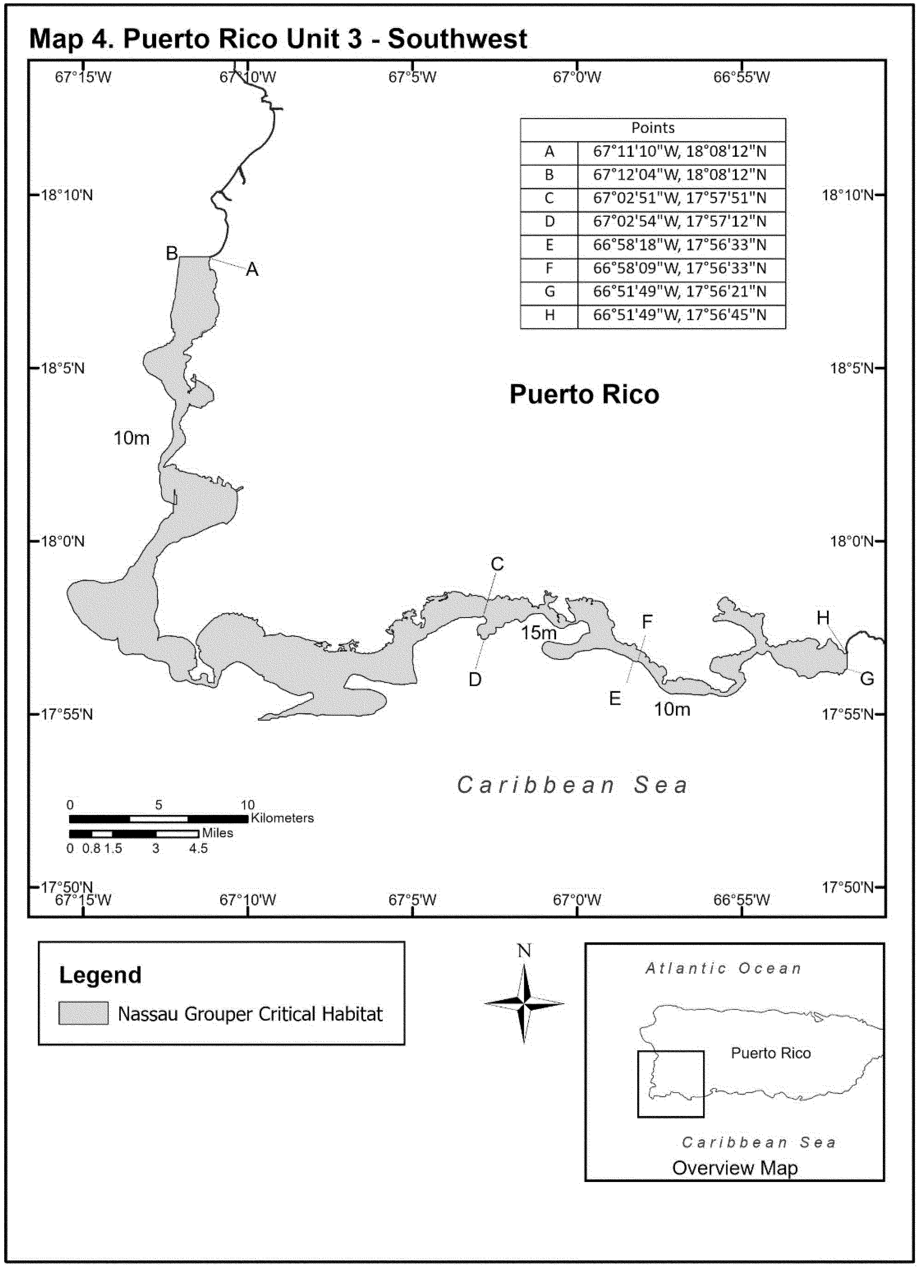
Start Printed Page 162
Start Printed Page 163
Start Printed Page 164
Start Printed Page 165
Start Printed Page 166
Start Printed Page 167
Start Printed Page 168
Start Printed Page 169
Start Printed Page 170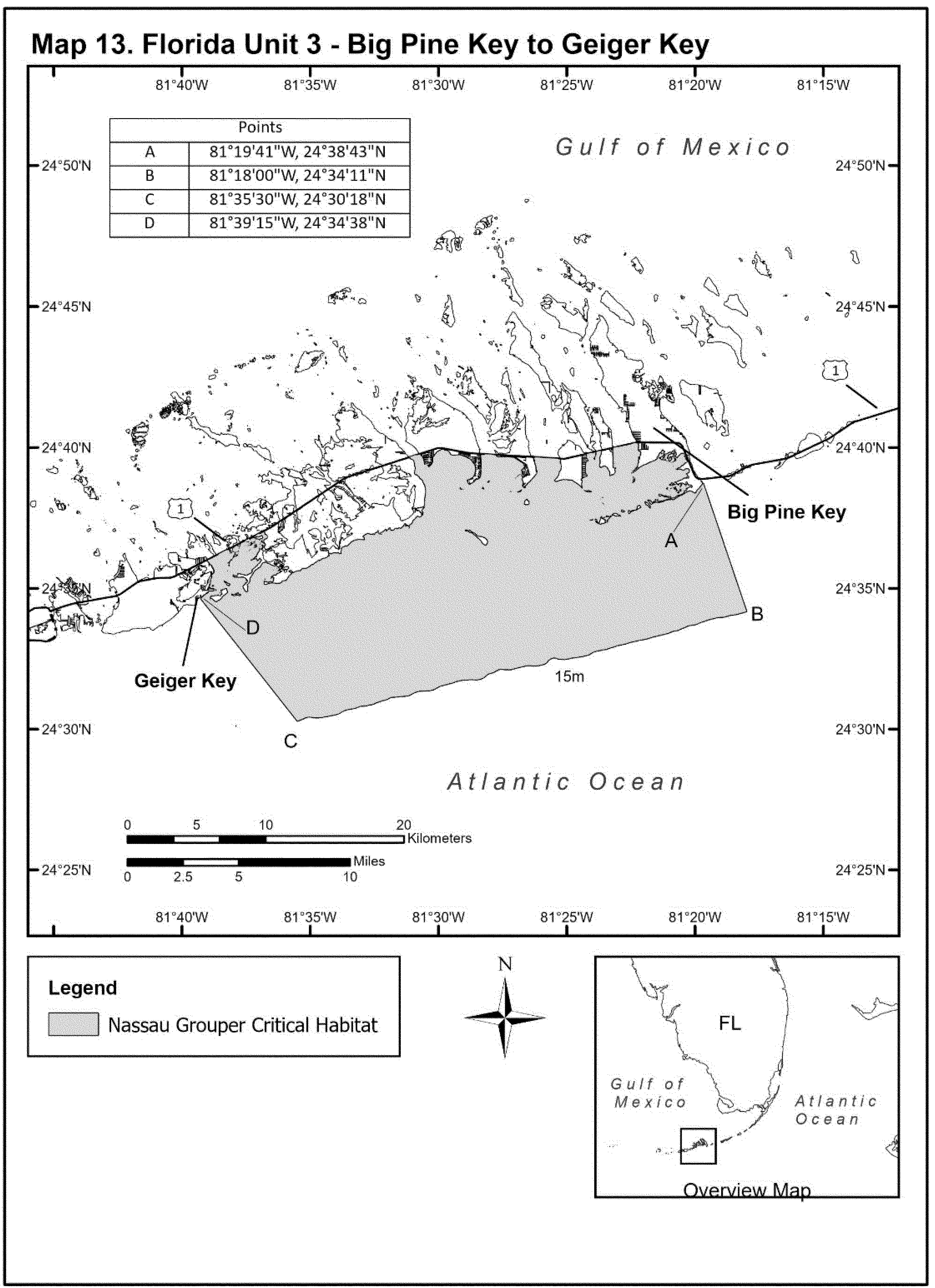
Start Printed Page 171
Start Printed Page 172
Start Printed Page 173
Start Printed Page 174
Start Printed Page 175
Start Printed Page 176
End Supplemental Information
Footnotes
* The exceptions are the Bajo de Sico spawning site unit and a portion of the Grammanik Bank/Hind Bank spawning site in the U.S. Caribbean, and Biscayne Bay in Florida.
Back to CitationBILLING CODE 3510–22–P
BILLING CODE 3510–22–C
BILLING CODE 3510–22–P
[FR Doc. 2023–28483 Filed 12–29–23; 8:45 am]
BILLING CODE 3510–22–C


Document Information
- Effective Date:
- 2/1/2024
- Published:
- 01/02/2024
- Department:
- National Oceanic and Atmospheric Administration
- Entry Type:
- Rule
- Action:
- Final rule.
- Document Number:
- 2023-28483
- Dates:
- This rule becomes effective February 1, 2024.
- Pages:
- 126-176 (51 pages)
- Docket Numbers:
- Docket No. 231219-0312
- RINs:
- 0648-BL53: Designation of Critical Habitat for Nassau Grouper Under the Endangered Species Act
- RIN Links:
- https://www.federalregister.gov/regulations/0648-BL53/designation-of-critical-habitat-for-nassau-grouper-under-the-endangered-species-act
- Topics:
- Endangered and threatened species, Exports, Imports, Transportation
- PDF File:
- 2023-28483.pdf
- CFR: (2)
- 50 CFR 223.102
- 50 CFR 226.231